
FCCInfo.com
A Service of Cavell, Mertz & Associates, Inc.
(855) FCC-INFO
|
|
|
|
|
||||||||||||||||
|
|
Status: License Application Accepted: 05/03/2023 License Expires: 02/01/2029 File Number: -0000214476 FCC Website Links: LMS Facility Details This Application Other W04DX-D Applications Including Superseded Applications Mailing Address Correspondence for W04DX-D Correspondence related to application -0000214476 Service Contour - Open Street Map or USGS Map (43 dBu) Service Contour - KML / Google Earth (43 dBu) Rabbit Ears Info Search for W04DX-D Site Location: 30-34-28.0 N 84-12-09.0 W (NAD 83) Site Location: 30-34-27.3 N 84-12-09.4 W (Converted to NAD 27) ERP: 1.88 kW Polarization: Horizontally polarized R/C AGL: 18.3 m (60 ft.) R/C AMSL: 62.3 m (204 ft.) Emission Mask: Full Service Site Elevation: 44 m. (144 ft.) Height Overall*: 274 m (899 ft.) (* As Filed In This Application, may differ from ASR Data, Below.) Directional Antenna - Antenna Make/Model: Scala CL-24 Antenna ID: 20780 Polarization: Horizontally polarized | ||||||||||||||||||
| Antenna Data for Antenna Id: 20780 W04DX-D LD File: -0000214476 Scala - CL-24 Service: LD Standard Pattern: Y Pattern and Field Values Include a 210° Clockwise Rotation | 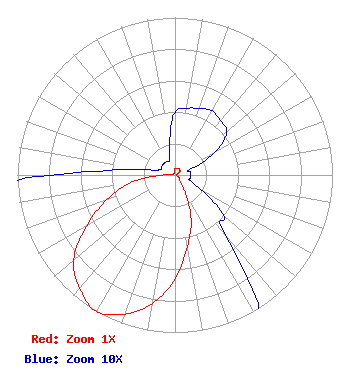 | ||||||||||||||||||
| Azimuth | Ratio | Azimuth | Ratio | Azimuth | Ratio | Azimuth | Ratio | ||||||||||||
| 0 | 0.040 | 10 | 0.043 | 20 | 0.045 | 30 | 0.047 | ||||||||||||
| 40 | 0.045 | 50 | 0.043 | 60 | 0.030 | 70 | 0.010 | ||||||||||||
| 80 | 0.010 | 90 | 0.010 | 100 | 0.010 | 110 | 0.010 | ||||||||||||
| 120 | 0.020 | 130 | 0.040 | 140 | 0.050 | 150 | 0.130 | ||||||||||||
| 160 | 0.300 | 170 | 0.460 | 180 | 0.660 | 190 | 0.830 | ||||||||||||
| 200 | 0.940 | 210 | 1.000 | 220 | 0.940 | 230 | 0.840 | ||||||||||||
| 240 | 0.650 | 250 | 0.460 | 260 | 0.290 | 270 | 0.080 | ||||||||||||
| 280 | 0.020 | 290 | 0.010 | 300 | 0.010 | 310 | 0.010 | ||||||||||||
| 320 | 0.010 | 330 | 0.010 | 340 | 0.010 | 350 | 0.020 | ||||||||||||
Structure Registration Number 1031203 Structure Type: GTOWER Registered To: Gray Media Group, Inc. Structure Address: 7927 Thomasville Road Tallahassee, FL County Name: Leon County ASR Issued: 06/30/2023 Date Built: 07/03/2017 Site Elevation: 44 m (144 ft.) Structure Height: 254 m (833 ft.) Height Overall: 274 m (899 ft.) Overall Height AMSL: 318 m (1043 ft.) FAA Determination: 08/04/2016 FAA Study #: 2016-ASO-19589-OE FAA Circular #: 70/7460-1L Paint & Light FAA Chapters: 3, 4, 5, 12 PRIOR STUDY 2003-ASO-5868-OE 30-34-28.0 N 84-12-09.0 W (NAD 83) 30-34-27.3 N 84-12-09.4 W (Converted to NAD 27) |
1671 Nw 144th Terrace Suite 106 Sunrise, FL 33323 Phone: 954-646-9456 Corporation | Title: President Date: 05/03/2023 Application Certifier King Forward, Inc. 1671 Nw 144th Terrace Suite 106 Sunrise, FL 33323 Applicant Greg Best Greg Best Consulting, Inc. 16100 Outlook Ave Stilwell, KS 66085 Consulting Engineer Mark Denbo Smithwick & Belendiuk, P.c. 5028 Wisconsin Avenue, N.w. Suite 301 Washington, DC 20016 Counsel | |||||||||||||||||