|
|
Antenna Structure Registration 1226866 |
 |
Registration Info | Registration Number: 1226866 |
| File Number: A1094840 |
| FAA Study: 2017-AWP-12854-OE |
| FAA Issue Date: 01/03/2018 |
| Status: Constructed |
| Date Constructed: 10/01/2001 |
| NEPA: N |
Structure Info
| Structure Type: LTOWER |
| Structure Coordinates: 40-2-1.9 N 124-2-25.3 W (NAD 83) |
| Structure Coordinates: 40-02-02.4 N 124-02-21.2 W (Converted to NAD 27) |
| Structure Address: Toth Road And Kelly Road Near Shelter Cove |
| Structure City: Shelter Cove, CA |
| Structure County: Humboldt County |
| Painting & Lighting Info |
FAA Chapters: NONE |
Remarks: PRIOR STUDY 2017-AWP-104-OE |
| Elevation Info |
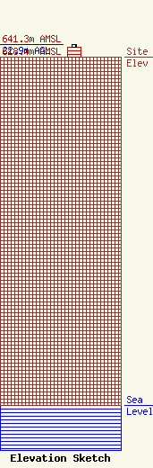
Site Elevation: 618.4 meters (2029 ft) |
| Height of Structure: 18.3 meters (60 feet) |
| Overall Height Above Ground: 22.9 meters (75 feet) |
| Overall Height Above Mean Sea Level: 641.3 meters (2104 feet) |
| Owner Info | Resort Improvement District No. 1
9126 Shelter Cove Road
Whitethorn, CA 95589
(707) 986-7447
sue@sheltercove-CA.gov |
| Contact Info | Resort Improvement District No. 1
9126 Shelter Cove Road
Whitethorn, CA 95589
Susan Sack
(707) 986-7447
sue@sheltercove-CA.gov |
