|
|
Antenna Structure Registration 1248659 |
 |
Registration Info | Registration Number: 1248659 |
| File Number: A1105955 |
| FAA Study: 2018-ANM-693-OE |
| FAA Issue Date: 03/19/2018 |
| Status: Constructed |
| Date Constructed: 06/10/2000 |
| NEPA: N |
Structure Info
| Structure Type: LTOWER |
| Structure Coordinates: 39-33-43.4 N 107-19-2.8 W (NAD 83) |
| Structure Coordinates: 39-33-43.5 N 107-19-00.6 W (Converted to NAD 27) |
| Structure Address: Iron Mountain, 1.3 Miles North Of |
| Structure City: Glenwood Springs, CO |
| Structure County: Garfield County |
| Painting & Lighting Info |
FAA Chapters: NONE |
Remarks: PRIOR STUDY 2005-ANM-1012-OE |
| Elevation Info |
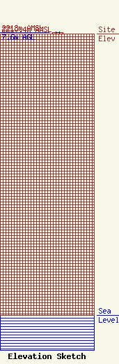
Site Elevation: 2210.4 meters (7252 ft) |
| Height of Structure: 7.6 meters (25 feet) |
| Overall Height Above Ground: 7.6 meters (25 feet) |
| Overall Height Above Mean Sea Level: 2218 meters (7277 feet) |
| Owner Info | POW, Inc.
51000 Two Rivers Plaza
Glenwood Springs, CO 81601
(970) 945-4228
jonbanks@jonbanksllc.com |
| Contact Info | POW, Inc.
51000 Two Rivers Plaza
Glenwood Springs, CO 81601
Steve Beckley
(970) 945-4228
jonbanks@jonbanksllc.com |
