|
|
Antenna Structure Registration 1005627 |
 |
Registration Info | Registration Number: 1005627 |
| File Number: A0816087 |
| FAA Study: 2003-AGL-6337-OE |
| FAA Issue Date: 11/26/2003 |
| Status: Constructed |
| Date Constructed: 07/13/2004 |
| FAA EMI: N |
| NEPA: N |
Structure Info
| Structure Type: TOWER |
| Structure Coordinates: 39-52-35.3 N 89-0-55.9 W (NAD 83) |
| Structure Coordinates: 39-52-35.2 N 89-00-55.6 W (Converted to NAD 27) |
| Structure Address: 3712 Pershing Rd. (bearsdale #90148) |
| Structure City: Decatur, IL |
| Structure County: Macon County |
| Painting & Lighting Info |
FAA Circular #: 70/7460-1K |
FAA Chapters: 4, 8, 12 |
Remarks: PRIOR STUDY 2002-AGL-1092-OE |
| Elevation Info |
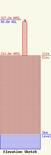
Site Elevation: 210.6 meters (691 ft) |
| Height of Structure: 91.4 meters (300 feet) |
| Overall Height Above Ground: 96.6 meters (317 feet) |
| Overall Height Above Mean Sea Level: 307.2 meters (1008 feet) |
| Owner Info | American Towers LLC
10 Presidential Way
Woburn, MA 01801
(678) 564-3236
faa-fcc@americantower.com |
| Contact Info | American Towers, LLC.
10 Presidential Way
Woburn, MA 01801
(678) 564-3236
faa-fcc@americantower.com |
