|
|
Antenna Structure Registration 1012992 |
 |
Registration Info | Registration Number: 1012992 |
| File Number: A1339707 |
| FAA Study: 2024-AGL-14602-OE |
| FAA Issue Date: 01/15/2025 |
| Status: Constructed |
| Date Constructed: 09/03/1980 |
| NEPA: N |
Structure Info
| Structure Type: GTOWER |
| Structure Coordinates: 41-22-57.9 N 81-42-5.9 W (NAD 83) |
| Structure Coordinates: 41-22-57.7 N 81-42-06.4 W (Converted to NAD 27) |
| Structure Address: 2861 Ridgewood Dr (oh189a5-a) |
| Structure City: Cleveland, OH |
| Structure County: Cuyahoga County |
| Painting & Lighting Info |
FAA Circular #: 70/7460-1M |
FAA Chapters: 4, 9, 15 |
Remarks: PRIOR STUDY 1997-AGL-600-OE |
| Elevation Info |
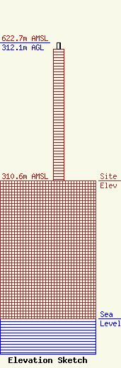
Site Elevation: 310.6 meters (1019 ft) |
| Height of Structure: 298.7 meters (980 feet) |
| Overall Height Above Ground: 312.1 meters (1024 feet) |
| Overall Height Above Mean Sea Level: 622.7 meters (2043 feet) |
| Owner Info | SBA Towers XI, LLC
8051 Congress Avenue
Boca Raton, FL 33487
(561) 995-7670
ERoach@sbasite.com |
| Contact Info | SBA Towers XI, LLC
8051 Congress Avenue
Boca Raton, FL 33487
(561) 995-7670
ERoach@sbasite.com |
