|
|
Antenna Structure Registration 1008931 |
 |
Registration Info | Registration Number: 1008931 |
| File Number: A1319488 |
| FAA Study: 2009-ANM-1918-OE |
| FAA Issue Date: 11/23/2009 |
| Status: Granted |
| Date Constructed: 01/01/1980 |
| NEPA: N |
Structure Info
| Structure Type: GTOWER |
| Structure Coordinates: 42-44-26.0 N 106-21-36.0 W (NAD 83) |
| Structure Coordinates: 42-44-26.1 N 106-21-33.9 W (Converted to NAD 27) |
| Structure Address: Casper Mountain 7.5 Mi Sw |
| Structure City: Casper, WY |
| Structure County: Natrona County |
| Painting & Lighting Info |
FAA Chapters: NONE |
Remarks: PRIOR STUDY 1992-ANM-465-OE |
| Elevation Info |
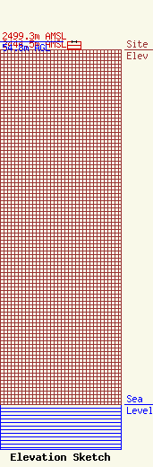
Site Elevation: 2444.5 meters (8020 ft) |
| Height of Structure: 54.8 meters (180 feet) |
| Overall Height Above Ground: 54.8 meters (180 feet) |
| Overall Height Above Mean Sea Level: 2499.3 meters (8200 feet) |
| Owner Info | BHTV License LLC
610 Peachtree Pkwy
Cumming, GA 30041
(678) 234-1271
drmichaelhogan@gmail.com |
| Contact Info | BakerHostetler LLP
1050 Connecticut Ave NW
Washington, DC 20036
Daniel Kirkpatrick
(202) 861-1758
dkirkpatrick@bakerlaw.com |
