|
|
Antenna Structure Registration 1035593 |
 |
Registration Info | Registration Number: 1035593 |
| File Number: A1221338 |
| FAA Study: 98-AGL-0611-OE |
| FAA Issue Date: 06/24/1998 |
| Status: Constructed |
| Date Constructed: 07/09/1978 |
| NEPA: N |
Structure Info
|
| Structure Coordinates: 43-14-56.0 N 87-58-50.0 W (NAD 83) |
| Structure Coordinates: 43-14-56.0 N 87-58-49.7 W (Converted to NAD 27) |
| Structure Address: 5555 W Highland Rd |
| Structure City: Mequon, WI |
| Structure County: Ozaukee County |
| Painting & Lighting Info |
FCC Paragraph(s): 1, 3, 11, 21 |
Remarks: RED LIGHTS/PAINT - PRIOR FAA 77-AGL-1953-OE |
| Elevation Info |
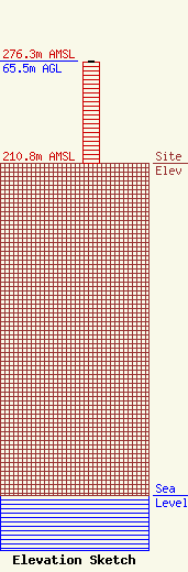
Site Elevation: 210.8 meters (692 ft) |
| Height of Structure: 64.8 meters (213 feet) |
| Overall Height Above Ground: 65.5 meters (215 feet) |
| Overall Height Above Mean Sea Level: 276.4 meters (907 feet) |
| Owner Info | Milwaukee Area Technical College District Board
1036 North 8th Street
Milwaukee, WI 53233
(414) 297-8028
schankd@matc.edu |
| Contact Info | Milwaukee Area Technical College District Board
1036 North 8th Street
Milwaukee, WI 53233
David Schank
(414) 297-8028
schankd@matc.edu |
