|
|
Antenna Structure Registration 1044415 |
 |
Registration Info | Registration Number: 1044415 |
| File Number: A0052420 |
| FAA Study: 96-ASO-5469-OE |
| FAA Issue Date: 12/12/1996 |
| Status: Constructed |
| Date Constructed: 09/01/1987 |
| NEPA: N |
Structure Info
| Structure Type: TOWER |
| Structure Coordinates: 39-1-49.0 N 84-30-22.0 W (NAD 83) |
| Structure Coordinates: 39-01-48.8 N 84-30-22.2 W (Converted to NAD 27) |
| Structure Address: 4802 Lookaway Dr |
| Structure City: Taylor Mill, KY |
| Structure County: Kenton County |
| Painting & Lighting Info |
FAA Circular #: 70/7460-1J |
FAA Chapters: 4, 5, 6, 8, 13 |
Remarks: Removed expiration date from determination. Scenario 1./jjs/case#635066 |
| Elevation Info |
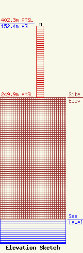
Site Elevation: 249.9 meters (820 ft) |
| Height of Structure: 146.3 meters (480 feet) |
| Overall Height Above Ground: 152.4 meters (500 feet) |
| Overall Height Above Mean Sea Level: 402.3 meters (1320 feet) |
| Owner Info | COMBINED TECHNOLOGIES INCORPORATED
1211 W SHARON RD
CINCINNATI, OH 45240
(513) 742-5555
|
