|
|
Antenna Structure Registration 1047708 |
 |
Registration Info | Registration Number: 1047708 |
| File Number: A1204366 |
| FAA Study: 02-ASW-2885-OE |
| FAA Issue Date: 08/26/2002 |
| Status: Dismantled |
| Date Constructed: 10/21/2002 |
| FAA EMI: N |
| NEPA: N |
Structure Info
|
| Structure Coordinates: 32-34-43.5 N 96-57-13.0 W (NAD 83) |
| Structure Coordinates: 32-34-43.0 N 96-57-12.0 W (Converted to NAD 27) |
| Structure Address: 483.72560c S Hwy 67 |
| Structure City: Cedar Hill, TX |
| Structure County: Dallas County |
| Painting & Lighting Info |
FAA Circular #: 70/7460-1J |
FAA Chapters: 3, 4, 5, 13 |
Remarks: Removed expiration date from determination. Scenario 1./jjs/case#635066 |
Remarks: PRIOR STUDY 98-ASW-3168-OE |
Remarks: Removed expiration date from determination. Scenario 1./jjs/case#635066 |
Remarks: PRIOR STUDY 98-ASW-3168-OE |
| Elevation Info |
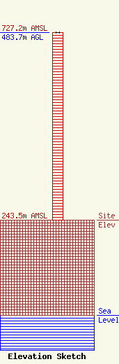
Site Elevation: 243.5 meters (799 ft) |
| Height of Structure: 482.7 meters (1584 feet) |
| Overall Height Above Ground: 483.7 meters (1587 feet) |
| Overall Height Above Mean Sea Level: 727.2 meters (2386 feet) |
| Owner Info | JA Bray, LLC
3161 Michelson
Irvine, CA 92612
(949) 261-7010
jtroutman@richlandinvestments.com |
| Contact Info | JA Bray, LLC
3161 Michelson
Irvine, CA 92612
John Troutman
(949) 261-7010
jtroutman@richlandinvestments.com |
