|
|
Antenna Structure Registration 1056898 |
 |
Registration Info | Registration Number: 1056898 |
| File Number: A1361869 |
| FAA Study: 2012-AGL-9528-OE |
| FAA Issue Date: 11/30/2012 |
| Status: Constructed |
| Date Constructed: 11/24/1998 |
| FAA EMI: N |
| NEPA: N |
Structure Info
| Structure Type: LTOWER |
| Structure Coordinates: 41-44-48.9 N 81-4-48.2 W (NAD 83) |
| Structure Coordinates: 41-44-48.7 N 81-04-48.8 W (Converted to NAD 27) |
| Structure Address: 5734 River Road |
| Structure City: Madison, OH |
| Structure County: Lake County |
| Painting & Lighting Info |
FAA Circular #: 70/7460-1J |
FAA Chapters: 4, 8, 13 |
Remarks: PRIOR STUDY 2005-AGL-5085-OE |
Remarks: OM&L to remain the same as prior study = A MED-DUAL SYSTEM |
Remarks: PRIOR STUDY 2005-AGL-5085-OE |
Remarks: OM&L to remain the same as prior study = A MED-DUAL SYSTEM |
| Elevation Info |
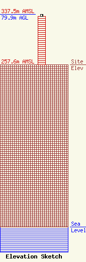
Site Elevation: 257.6 meters (845 ft) |
| Height of Structure: 76.2 meters (250 feet) |
| Overall Height Above Ground: 79.9 meters (262 feet) |
| Overall Height Above Mean Sea Level: 337.5 meters (1107 feet) |
| Owner Info | STC Two LLC
12920 SE 38th Street
Bellevue, WA 98006
(425) 383-8401
FCCRegulatoryComplianceContact@t-mobile.com |
| Contact Info | Crown Castle
2000 Corporate Drive
Canonsburg, PA 15317
Tom Anderson
(724) 743-6330
Tom.Anderson@crowncastle.com |
