|
|
Antenna Structure Registration 1061590 |
 |
Registration Info | Registration Number: 1061590 |
| File Number: A0072078 |
| Status: Constructed |
| Date Constructed: 09/01/1978 |
| NEPA: N |
Structure Info
| Structure Type: TOWER |
| Structure Coordinates: 34-13-45.0 N 118-4-6.0 W (NAD 83) |
| Structure Coordinates: 34-13-45.0 N 118-04-02.8 W (Converted to NAD 27) |
| Structure Address: Mount Wilson |
| Structure City: La Canada, CA |
| Structure County: Los Angeles County |
| Painting & Lighting Info |
FCC Paragraph(s): None |
| Elevation Info |
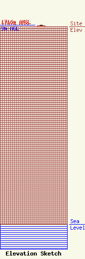
Site Elevation: 1707 meters (5600 ft) |
| Height of Structure: 6 meters (20 feet) |
| Overall Height Above Ground: 9 meters (30 feet) |
| Overall Height Above Mean Sea Level: 1716 meters (5630 feet) |
| Owner Info | LOS ANGELES, COUNTY OF
1110 N EASTERN AVE
LOS ANGELES, CA 90063-3297
(323) 267-3004
GPOON@CO.LA.CA.US |
