|
|
Antenna Structure Registration 1208331 |
 |
Registration Info | Registration Number: 1208331 |
| File Number: A0803058 |
| FAA Study: 97-AGL-4754-OE |
| FAA Issue Date: 11/28/1997 |
| Status: Constructed |
| Date Constructed: 10/01/1998 |
| FAA EMI: N |
| NEPA: N |
Structure Info
| Structure Type: TOWER |
| Structure Coordinates: 42-58-35.1 N 83-46-10.8 W (NAD 83) |
| Structure Coordinates: 42-58-35.0 N 83-46-11.0 W (Converted to NAD 27) |
| Structure Address: G4511 Miller Road |
| Structure City: Flint, MI |
| Structure County: Genesee County |
| Painting & Lighting Info |
FAA Chapters: NONE |
| Elevation Info |
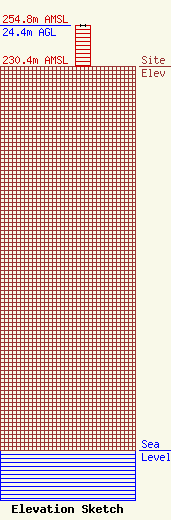
Site Elevation: 230.4 meters (756 ft) |
| Height of Structure: 24.4 meters (80 feet) |
| Overall Height Above Ground: 24.4 meters (80 feet) |
| Overall Height Above Mean Sea Level: 254.8 meters (836 feet) |
| Owner Info | Krol Communications, Inc.
103 North Washington
Owosso, MI 48867
Rod Krol
(517) 331-6376
rodk@z925.com |
| Info |
