|
|
Antenna Structure Registration 1221073 |
 |
Registration Info | Registration Number: 1221073 |
| File Number: A1099987 |
| FAA Study: 2016-AWP-10915-OE |
| FAA Issue Date: 11/21/2016 |
| Status: Constructed |
| Date Constructed: 07/15/2001 |
| NEPA: N |
Structure Info
| Structure Type: LTOWER |
| Structure Coordinates: 34-13-35.3 N 118-4-0.9 W (NAD 83) |
| Structure Coordinates: 34-13-35.3 N 118-03-57.7 W (Converted to NAD 27) |
| Structure Address: Us Post Office/near Center Of Tower Farm/mt. Wilson-5 Site #007510 |
| Structure City: Altadena, CA |
| Structure County: Los Angeles County |
| Painting & Lighting Info |
FAA Circular #: 70/7460-1L |
FAA Chapters: 4, 5, 12 |
Remarks: PRIOR STUDY 2016-AWP-163-OE |
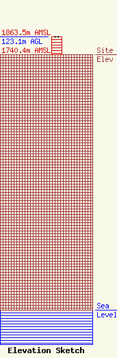
| Elevation Info |
Site Elevation: 1740.4 meters (5710 ft) |
| Height of Structure: 121.9 meters (400 feet) |
| Overall Height Above Ground: 123.1 meters (404 feet) |
| Overall Height Above Mean Sea Level: 1863.5 meters (6114 feet) |
| Owner Info | American Towers LLC
10 Presidential Way
Woburn, MA 01801
(678) 564-3236
faa-fcc@americantower.com |
| Contact Info | American Towers, LLC.
10 Presidential Way
Woburn, MA 01801
(678) 564-3236
faa-fcc@americantower.com |
