|
|
Antenna Structure Registration 1232673 |
 |
Registration Info | Registration Number: 1232673 |
| File Number: A0622133 |
| FAA Study: 02-ASW-0454-OE |
| Status: Terminated |
| Date Constructed: 06/30/1994 |
| FAA EMI: N |
| NEPA: N |
Structure Info
| Structure Type: MAST |
| Structure Coordinates: 34-46-4.7 N 92-25-43.9 W (NAD 83) |
| Structure Coordinates: 34-46-04.4 N 92-25-43.3 W (Converted to NAD 27) |
| Structure Address: 13800 Morrison Road |
| Structure City: Little Rock, AR |
| Structure County: Pulaski County |
| Painting & Lighting Info |
FAA Chapters: NONE |
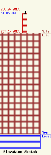
| Elevation Info |
Site Elevation: 237.1 meters (778 ft) |
| Height of Structure: 45.7 meters (150 feet) |
| Overall Height Above Ground: 51.8 meters (170 feet) |
| Overall Height Above Mean Sea Level: 288.9 meters (948 feet) |
| Owner Info | Alltel Cellular Associates of Arkansas Limited Partnership
1120 Sanctuary Pkwy #150 GASAREG
Alpharetta, GA 30009-7630
(770) 797-1070
Network.Regulatory@VerizonWireless.com |
| Contact Info | Verizon Wireless
1120 Sanctuary Pkwy #150 GASAREG
Alpharetta, GA 30009-7630
Jerri Janjua
(770) 797-1070
Network.Regulatory@VerizonWireless.com |
