|
|
Antenna Structure Registration 1240997 |
 |
Registration Info | Registration Number: 1240997 |
| File Number: A0410805 |
| FAA Study: 2003-ANM-1720-OE |
| FAA Issue Date: 09/22/2003 |
| Status: Constructed |
| Date Constructed: 08/01/2004 |
| FAA EMI: N |
| NEPA: N |
Structure Info
| Structure Type: TOWER |
| Structure Coordinates: 42-43-45.5 N 114-24-55.9 W (NAD 83) |
| Structure Coordinates: 42-43-45.8 N 114-24-52.8 W (Converted to NAD 27) |
| Structure Address: 547 Flat Top Butte Road |
| Structure City: Jerome, ID |
| Structure County: Jerome County |
| Painting & Lighting Info |
FAA Chapters: NONE |
Remarks: Removed expiration and final dates from determination. Scenario 2./jjs/case#635066 |
| Elevation Info |
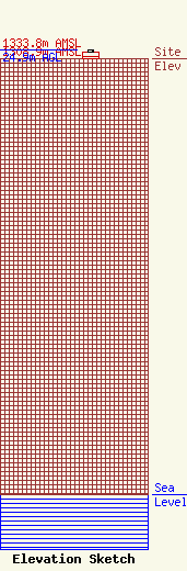
Site Elevation: 1308.9 meters (4294 ft) |
| Height of Structure: 18.3 meters (60 feet) |
| Overall Height Above Ground: 24.9 meters (82 feet) |
| Overall Height Above Mean Sea Level: 1333.8 meters (4376 feet) |
| Owner Info | Idaho Public Television
1455 N. Orchard Street
Boise, ID 83706
(208) 373-7220
|
