|
|
Antenna Structure Registration 1241143 |
 |
Registration Info | Registration Number: 1241143 |
| File Number: A0354923 |
| FAA Study: 2003-AEA-2404-OE |
| FAA Issue Date: 10/08/2003 |
| Status: Granted |
| NEPA: N |
Structure Info
| Structure Type: TOWER |
| Structure Coordinates: 38-24-28.0 N 81-54-12.0 W (NAD 83) |
| Structure Coordinates: 38-24-27.7 N 81-54-12.5 W (Converted to NAD 27) |
| Structure Address: Poplar Fork Road |
| Structure City: St. Albans, WV |
| Structure County: Putnam County |
| Painting & Lighting Info |
FAA Circular #: 70/7460-1K |
FAA Chapters: 4, 9, 12 |
Remarks: Removed expiration and final dates from determination. Scenario 2./jjs/case#635066 |
Remarks: PRIOR STUDY 1962-AEA-3-OE |
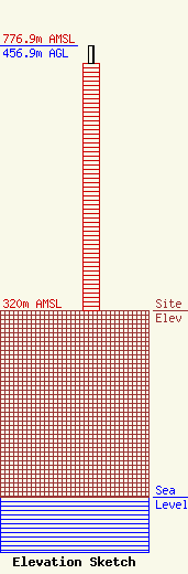
| Elevation Info |
Site Elevation: 320 meters (1050 ft) |
| Height of Structure: 426.1 meters (1398 feet) |
| Overall Height Above Ground: 456.9 meters (1499 feet) |
| Overall Height Above Mean Sea Level: 776.9 meters (2549 feet) |
| Owner Info | Sinclair Media III, Inc.
10706 Beaver Dam Road
Cockeysville, MD 21030
(410) 568-1500
|
