|
|
Antenna Structure Registration 1242684 |
 |
Registration Info | Registration Number: 1242684 |
| File Number: A1297474 |
| FAA Study: 04-ASW-5362-OE |
| FAA Issue Date: 11/04/2004 |
| Status: Constructed |
| Date Constructed: 01/25/2005 |
| FAA EMI: N |
| NEPA: N |
Structure Info
| Structure Type: TOWER |
| Structure Coordinates: 32-16-55.4 N 101-29-35.5 W (NAD 83) |
| Structure Coordinates: 32-16-55.0 N 101-29-34.0 W (Converted to NAD 27) |
| Structure Address: 1500ft Se Of Intersection Us Rt.87 And Leatherwood Rd. |
| Structure City: Big Spring, TX |
| Structure County: Howard County |
| Painting & Lighting Info |
FAA Circular #: 70/7460-1K |
FAA Chapters: 4, 8, 12 |
Remarks: PRIOR STUDY 2003-ASW-5581-OE |
Remarks: Removed expiration date from determination. Scenario 1./jjs/case#635066 |
Remarks: PRIOR STUDY 2003-ASW-5581-OE |
Remarks: Removed expiration date from determination. Scenario 1./jjs/case#635066 |
| Elevation Info |
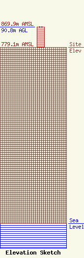
Site Elevation: 779.1 meters (2556 ft) |
| Height of Structure: 90.8 meters (298 feet) |
| Overall Height Above Ground: 90.8 meters (298 feet) |
| Overall Height Above Mean Sea Level: 869.9 meters (2854 feet) |
| Owner Info | Gray Local Media, Inc.
4370 Peachtree Road, NE
Atlanta, GA 30319
(404) 266-8333
legalnotices@graymedia.com |
| Contact Info | Gray Local Media, Inc.
4370 Peachtree Road NE
Atlanta, GA 30319
Engineering Department
(404) 266-8333
legalnotices@graymedia.com |
