|
|
Antenna Structure Registration 1248490 |
 |
Registration Info | Registration Number: 1248490 |
| File Number: A1096665 |
| FAA Study: 2018-AWP-114-OE |
| FAA Issue Date: 01/26/2018 |
| Status: Constructed |
| Date Constructed: 04/06/2005 |
| NEPA: N |
Structure Info
| Structure Type: MTOWER |
| Structure Coordinates: 34-6-30.2 N 118-3-28.8 W (NAD 83) |
| Structure Coordinates: 34-06-30.2 N 118-03-25.6 W (Converted to NAD 27) |
| Structure Address: 5938 Kaufman Avenue |
| Structure City: Temple City, CA |
| Structure County: Los Angeles County |
| Painting & Lighting Info |
FAA Chapters: NONE |
Remarks: PRIOR STUDY 2008-AWP-4762-OE |
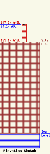
| Elevation Info |
Site Elevation: 123.1 meters (404 ft) |
| Height of Structure: 24.1 meters (79 feet) |
| Overall Height Above Ground: 24.1 meters (79 feet) |
| Overall Height Above Mean Sea Level: 147.2 meters (483 feet) |
| Owner Info | CCATT LLC
2000 Corporate Drive
Canonsburg, PA 15317
(724) 416-2000
Regulatory.Department@Crowncastle.com |
| Contact Info | Crown Castle
2000 Corporate Drive
Canonsburg, PA 15317
Don Snyder
(724) 416-2470
Don.Snyder@crowncastle.com |
