|
|
Antenna Structure Registration 1028319 |
 |
Registration Info | Registration Number: 1028319 |
| File Number: A1150186 |
| FAA Study: 97-AEA-0748-OE |
| Status: Constructed |
| Date Constructed: 10/06/1986 |
| FAA EMI: N |
| NEPA: N |
Structure Info
|
| Structure Coordinates: 37-11-56.0 N 80-9-0.0 W (NAD 83) |
| Structure Coordinates: 37-11-55.5 N 80-09-00.9 W (Converted to NAD 27) |
| Structure Address: Atop Poor Mountain |
| Structure City: Roanoke, VA |
| Structure County: Roanoke County |
| Painting & Lighting Info |
FAA Circular #: 70/7460-1J |
FAA Chapters: 3, 4, 5, 13 |
| Elevation Info |
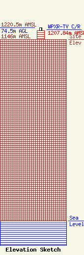
Site Elevation: 1146 meters (3760 ft) |
| Height of Structure: 54.7 meters (179 feet) |
| Overall Height Above Ground: 74.5 meters (244 feet) |
| Overall Height Above Mean Sea Level: 1220.5 meters (4004 feet) |
| WPXR-TV C/R Height Above Mean Sea Level: 1207.84 meters (3963 ft)
|
| Owner Info | ION Station Properties, LLC
601 Clearwater Park Road
West Palm Beach, FL 33401
(561) 682-4110
BiancaFrye@ionmedia.com |
| Contact Info | ION Media Networks
601 Clearwater Park Road
West Palm Beach, FL 33401
Bianca Frye
(561) 682-4110
BiancaFrye@ionmedia.com |
