|
|
Antenna Structure Registration 1269244 |
 |
Registration Info | Registration Number: 1269244 |
| File Number: A0644854 |
| FAA Study: 2006-ANM-4525-OE |
| FAA Issue Date: 01/10/2007 |
| Status: Granted |
| NEPA: N |
Structure Info
| Structure Type: POLE |
| Structure Coordinates: 38-31-41.4 N 106-54-16.7 W (NAD 83) |
| Structure Coordinates: 38-31-41.4 N 106-54-14.5 W (Converted to NAD 27) |
| Structure Address: 1.5 Miles South East Of The Gunnison Airport |
| Structure City: Gunnison, CO |
| Structure County: Gunnison County |
| Painting & Lighting Info |
FAA Circular #: |
FAA Chapters: NONE |
Remarks: PRIOR STUDY 2003-ANM-531-OE |
| Elevation Info |
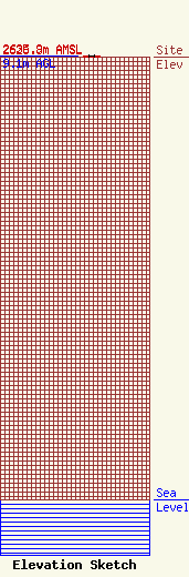
Site Elevation: 2626.8 meters (8618 ft) |
| Height of Structure: 9.1 meters (30 feet) |
| Overall Height Above Ground: 9.1 meters (30 feet) |
| Overall Height Above Mean Sea Level: 2635.9 meters (8648 feet) |
| K13AV-D C/R Height Above Mean Sea Level: 2636.1 meters (8649 ft)
|
| Owner Info | Gunnison County Metropolitan Recreation District
1382
Gunnison, CO 81230
(970) 641-8725
admin@gcmetrec.com |
