Accept
By using FCCInfo you agree to the terms & conditions. Read disclaimer Read privacy statement
FCCInfo.com

A Service of Cavell, Mertz & Associates, Inc.
(855) FCC-INFO

WLXK(FM)
Call Sign History
WLXK from 11/05/2014
WRZM from 12/25/2013
WGWG from ???
88.3 MHz

Boiling Springs, NC
License
CP
Application
Allocation
STA


WLXK Channel: 202C2 88.3 MHz
Boiling Springs, North Carolina
Service: FM - A full-service FM station or application.
Facility ID: 23156
FRN: 0004121000
Fac. Service: FM

Status: LIC
Application Accepted: 02/21/1995
Application Granted: 06/26/1995
File Number: BLED-19950221KD
License Expires: 12/01/2027
Prefix Type: This is a license for a noncommercial educational FM station
Application Type: License To Cover

FCC Website Links:
  LMS Facility Details
  This Application
  Other WLXK Applications
  Including Superseded Applications
  Service Contour - Open Street Map or USGS Map (60 dBu)
  Service Contour - KML / Google Earth (60 dBu)
  Public Inspection Files

Facility Type: NON-COMMERCIAL EDUC. FM
Class: C2, A Zone II station; with 25kW-50kW ERP and a class contour distance 39km-52km

Site Location: 35-13-52.4 N 81-42-56.4 W (NAD 83)
Site Location: 35-13-52.0 N 81-42-57.0 W (Converted to NAD 27)

Effective Radiated Power: 50 kW
Transmitter Output Power: 13 kW
Antenna Center HAAT: 92 m (302 ft.)
Antenna Center AMSL: 343 m (1125 ft.)
Antenna Center HAG: 75 m (246 ft.)

Calculated Site Elevation: 268 m. (879 ft.)
Height Overall*: 83 m (272 ft.)
(* As Filed In This Application, may differ from ASR Data, Below.)
Directional Antenna
Antenna Make/Model: Continental G5CPM-6E-DA_HW
Antenna ID: 14231
Polarization:

Antenna Data for Antenna Id: 14231
WLXK FM File: BLED-19950221KD
Continental - G5CPM-6E-DA_HW
Service: FM
AzimuthRatioAzimuthRatioAzimuthRatioAzimuthRatio
00.57450.565100.551200.506
300.447400.402500.379600.374
700.394800.469900.5891000.722
1100.8411200.9261300.9801401.000
1501.0001601.0001701.0001801.000
1901.0002001.0002101.0002201.000
2300.9932400.9542500.8722600.744
2700.6162800.5092900.4353000.407
3100.4073200.4363250.4603300.490
3350.5203400.5443450.5623500.573
3550.578
Structure Information

Structure Registration Number 1007399

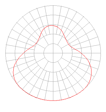
[ASR Heights Differ from WLXK Application]
Structure Type: TOWER
Registered To:
Educational Media Foundation
Structure Address:
103 Walton Dr
Mooresboro, NC
County Name: Cleveland County
ASR Issued: 09/29/2015
Date Built: 01/04/1995
Site Elevation: 268 m (879 ft.)
Structure Height: 82 m (269 ft.)
Height Overall: 82 m (269 ft.)
Overall Height AMSL: 350 m (1148 ft.)
FAA Determination: 11/04/1991
FAA Study #: 91-ASO-0979-OE
FAA Circular #: 70/7460-1H
Paint & Light FAA Chapters: 3, 4, 5, 13
35-13-52.0 N 81-42-56.0 W (NAD 83)
35-13-51.6 N 81-42-56.6 W
(Converted to NAD 27)
WLXK(FM) Licensee Information

Educational Media Foundation
5700 West Oaks Blvd.
Rocklin, CA 95765
Phone: 916-251-1600
Not-for-Profit
19950221KD Applicant Information


Date: 02/21/1995
Application Certifier
Gardner-Webb Junior College, Inc.
P.O. Box 997
106 Emily Lane
Boiling Springs, NC 28017
Applicant
Associated Land Mobile Licenses


(No Records Found)
Associated Microwave Licenses


(No Records Found)

Study Date: 4/30/2025; Study Duration: 0.1278 Seconds.
Database Sources:
04/30/2025 FCC LMS,
4/29/2025 FCC ASR,
4/29/2025 FCC ULS Microwave, and
4/29/2025 FCC ULS Broadcast Land Mobile.


© 2025 Capitol Airspace Group, LLC.
Alexandria, Virginia


If you have questions or concerns about the station above please contact the station Licensee.
Comments and questions about FCCInfo can be emailed to: webmaster@fccinfo.com