|
KILV Channel: 298C3 107.5 MHz
Castana, Iowa
Service: FM - A full-service FM station or application.
Facility ID: 87226
FRN: 0035489673
Fac. Service: FM
Status: LIC (Licensed And Reduced Power)
73.215 Station
Application Accepted: 07/17/2020
Application Granted: 10/05/2020
File Number: 0000118031
License Expires: 02/01/2029
Application Type: Minor Modification
FCC Website Links:
LMS Facility Details
This Application
Other KILV Applications
Including Superseded Applications
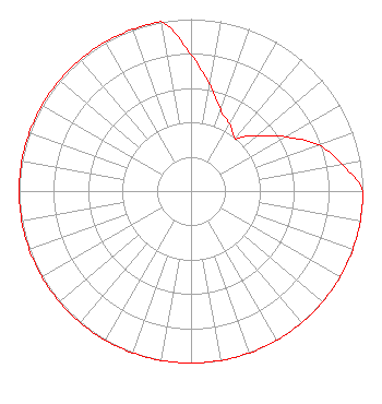
Service Contour - Open Street Map or USGS Map (60 dBu)
Service Contour - KML / Google Earth (60 dBu)
Public Inspection Files
Facility Type: NON-COMMERCIAL EDUC. FM
Class: C3, A Zone II station; with 6kW-25kW ERP and a class contour distance 28km-39km
Site Location: 42-12-26.6 N 96-07-28.3 W (NAD 83)
Site Location: 42-12-26.6 N 96-07-27.2 W (Converted to NAD 27)
Effective Radiated Power: 25 kW
Transmitter Output Power: 11 kW
Antenna Center HAAT: 100 m (328 ft.)
Antenna Center AMSL: 432 m (1417 ft.)
Antenna Center HAG: 107 m (351 ft.)
Site Elevation: 325 m. (1066 ft.)
Height Overall*: 115 m (377 ft.)
(* As Filed In This Application, may differ from ASR Data, Below.)
Directional Antenna
Antenna Make/Model: Electronics Research Inc. MP-6E-DA-HW
Antenna ID: 39881
Polarization:
| Associated Translators |
| K261DY(FX) |
Ch. 261 | Sioux City, Iowa |
|
Structure Information
Structure Registration Number 1204144
Structure Type: GTOWER
Registered To:
K-LOVE, Inc.
Structure Address:
0.6 Miles Sw Of 340th Road, 2.1 Miles Sw Of Hornick
Hornick, IA
County Name: Monona County
ASR Issued: 02/05/2026
Date Built: 07/10/2020
Site Elevation: 324.6 m (1065 ft.)
Structure Height: 114.3 m (375 ft.)
Height Overall: 115.2 m (378 ft.)
Overall Height AMSL: 439.8 m (1443 ft.)
FAA Determination: 07/08/2020
FAA Study #: 2020-ACE-4709-OE
FAA Circular #: 70/7460-1J
Paint & Light FAA Chapters: 3, 4, 5, 13
PRIOR STUDEY 2002-ACE-2059-OE
42-12-26.6 N 96-07-28.3 W (NAD 83)
42-12-26.6 N 96-07-27.2 W
(Converted to NAD 27)
|
KILV(FM) Licensee Information
K-Love, Inc.
2000 Reams Fleming Boulevard
Franklin, TN 37064
Phone: 916-251-1600
Not-for-Profit | 0000118031 Applicant Information
Jon William Reeves
Title: Ceo
Date: 07/17/2020
Application Certifier
Educational Media Foundation
Educational Media Foundation
5700 West Oaks Blvd
Rocklin, CA 95765
Applicant
James L Travis
Educational Media Foundation
5700 West Oaks Blvd.
Rocklin, CA 95765
FCC Compliance Engineer
Mary O'Connor, Esq
Wilkinson Barker Knauer, LLP
1800 M Street, N.W.
Suite 800N
Washington, DC 20036
Legal Representative
|