Accept
By using FCCInfo you agree to the terms & conditions. Read disclaimer Read privacy statement
FCCInfo.com

A Service of Cavell, Mertz & Associates, Inc.
(855) FCC-INFO

W224EE(FX)
Call Sign History
W224EE from 06/08/2018
92.7 MHz

Charleston, WV
License
CP
Application
Allocation
STA


W224EE Channel: 224D 92.7 MHz
Charleston, West Virginia
Service: FX - A translator or application for a translator.
Facility ID: 202928
FRN: 0002071504
Fac. Service: FX
Programming Delivery Method: Unspecified

Status: LIC
Application Accepted: 05/10/2021
Application Granted: 06/14/2021
File Number: 0000144995
License Expires: 10/01/2027
Application Type: License To Cover

FCC Website Links:
  LMS Facility Details
  This Application
  Other W224EE Applications
  Including Superseded Applications
  Service Contour - Open Street Map or USGS Map (60 dBu)
  Service Contour - KML / Google Earth (60 dBu)

Facility Type: FM STATION
Class: D, A Noncommercial educational operating with no more than 10W

Site Location: 38-21-26.3 N 81-40-04.5 W (NAD 83)
Site Location: 38-21-26.0 N 81-40-05.1 W (Converted to NAD 27)

Effective Radiated Power: 0.25 kW
Transmitter Output Power: 0.52 kW
Antenna Center AMSL: 314 m (1030 ft.)
Antenna Center HAG: 22 m (72 ft.)

Site Elevation: 292 m. (958 ft.)
Height Overall*: 105 m (344 ft.)
(* As Filed In This Application, may differ from ASR Data, Below.)
Directional Antenna
Antenna Make/Model: Jampro JLLP
Antenna ID: 132576
Polarization: H

Primary Station
WBES Ch. 0Charleston, West Virginia
Antenna Data for Antenna Id: 132576
W224EE FX File: -0000144995
Jampro - JLLP
Service: FX
AzimuthRatioAzimuthRatioAzimuthRatioAzimuthRatio
01.000101.000201.000301.000
401.000500.984600.870700.823
800.831900.8711000.8981100.904
1200.8231300.7181400.4771500.365
1600.3041700.2451800.2071900.203
2000.1702100.1632200.1742300.210
2400.3162500.5982600.8372700.951
2801.0002901.0003001.0003101.000
3201.0003301.0003401.0003501.000
Structure Information

Structure Registration Number 1033439

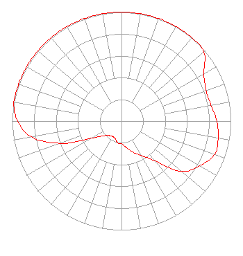
[ASR Heights Differ from W224EE Application]
Structure Type: TOWER
Registered To:
BRISTOL BROADCASTING COMPANY INC
Structure Address:
817 Suncrest Pl
Charleston, WV
County Name: Kanawha County
ASR Issued: 01/14/2013
Date Built: 01/01/1984
Site Elevation: 292.6 m (960 ft.)
Structure Height: 84.1 m (276 ft.)
Height Overall: 105.5 m (346 ft.)
Overall Height AMSL: 398.1 m (1306 ft.)
FAA Determination: 06/18/1984
FAA Study #: 84-AEA-1045-OE
Paint & Light FAA Chapters: 1, 3, 12, 21
RED LIGHTS/PAINT
38-21-26.0 N 81-40-04.0 W (NAD 83)
38-21-25.7 N 81-40-04.6 W
(Converted to NAD 27)
W224EE(FX) Licensee Information

Bristol Broadcasting Company, Inc.
901 East Valley Drive
Bristol, VA 24201
Phone: 276-669-8112
Corporation
0000144995 Applicant Information

Roger Bouldin
Title: Corporate General Manager/Director
Date: 05/10/2021
Application Certifier
Bristol Broadcasting Company, Inc.
901 East Valley Drive
Bristol, VA 24201
Applicant
Roger D Bouldin
Bristol Broadcasting Company, Inc.
901 East Valley Drive
Bristol, VA 24201
Director/Engineer
Roger Bouldin
Bristol Broadcasting Company, Inc.
901 East Valley Drive
Bristol, VA 24201
Corporate General Manager/Director
Associated Land Mobile Licenses


(No Records Found)
Associated Microwave Licenses


(No Records Found)

Study Date: 5/01/2025; Study Duration: 0.0726 Seconds.
Database Sources:
04/30/2025 FCC LMS,
4/29/2025 FCC ASR,
4/29/2025 FCC ULS Microwave, and
4/29/2025 FCC ULS Broadcast Land Mobile.


© 2025 Capitol Airspace Group, LLC.
Alexandria, Virginia


If you have questions or concerns about the station above please contact the station Licensee.
Comments and questions about FCCInfo can be emailed to: webmaster@fccinfo.com