Accept
By using FCCInfo you agree to the terms & conditions. Read disclaimer Read privacy statement
FCCInfo.com

A Service of Cavell, Mertz & Associates, Inc.
(855) FCC-INFO

WMWA(FM)
Call Sign History
WMWA from 10/05/2021
WVNV from 08/09/1991
881116MA from ???
96.5 MHz

Malone, NY
License
CP
Application
Allocation
STA


WMWA Channel: 243C3 96.5 MHz
Malone, New York
Service: FM - A full-service FM station or application.
Facility ID: 36121
FRN: 0004121000
Fac. Service: FM

Status: LIC
73.215 Station
Application Accepted: 10/20/2021
Application Granted: 10/21/2021
File Number: 0000157511
License Expires: 06/01/2030
Application Type: Minor Amendment

FCC Website Links:
  LMS Facility Details
  This Application
  Other WMWA Applications
  Including Superseded Applications
  Service Contour - Open Street Map or USGS Map (60 dBu)
  Service Contour - KML / Google Earth (60 dBu)
  Public Inspection Files

Facility Type: NON-COMMERCIAL EDUC. FM
Class: C3, A Zone II station; with 6kW-25kW ERP and a class contour distance 28km-39km

Site Location: 44-46-56.0 N 74-13-08.0 W (NAD 83)
Site Location: 44-46-55.8 N 74-13-09.4 W (Converted to NAD 27)

Effective Radiated Power: 23.5 kW
Transmitter Output Power: 4.4 kW
Antenna Center HAAT: 105 m (344 ft.)
Antenna Center AMSL: 519 m (1703 ft.)
Antenna Center HAG: 61 m (200 ft.)

Site Elevation: 458.1 m. (1503 ft.)
Height Overall*: 92.1 m (302 ft.)
(* As Filed In This Application, may differ from ASR Data, Below.)
Directional Antenna
Antenna Make/Model: Systems With Reliability Inc. FM3d/4-DA,4 sections
Antenna ID: 68161
Polarization: H

Antenna Data for Antenna Id: 68161
WMWA FM File: -0000157511
Systems With Reliability Inc. - FM3d/4-DA,4 sections
Service: FM
AzimuthRatioAzimuthRatioAzimuthRatioAzimuthRatio
00.635100.740200.800300.760
400.900501.000601.000701.000
801.000901.0001001.0001101.000
1201.0001301.0001401.0001501.000
1601.0001701.0001801.0001901.000
2001.0002101.0002201.0002301.000
2400.9492500.7542600.5992700.475
2800.3782900.3003000.2703100.285
3200.3203300.4033400.5073500.633
Structure Information

Structure Registration Number 1064217

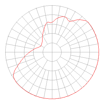
[ASR Heights Differ from WMWA Application]
Structure Type: GTOWER
Registered To:
Educational Media Foundation
Structure Address:
Off Teboville Road
Malone, NY
County Name: Franklin County
ASR Issued: 12/14/2023
Date Built: 05/05/1999
Site Elevation: 460.2 m (1510 ft.)
Structure Height: 74.4 m (244 ft.)
Height Overall: 74.4 m (244 ft.)
Overall Height AMSL: 534.6 m (1754 ft.)
FAA Determination: 09/28/2023
FAA Study #: 2022-AEA-12807-OE
FAA Circular #: 70/7460-1M
Paint & Light FAA Chapters: 3, 4, 5, 15
44-46-53.8 N 74-13-06.8 W (NAD 83)
44-46-53.6 N 74-13-08.2 W
(Converted to NAD 27)
WMWA(FM) Licensee Information

Educational Media Foundation
5700 West Oaks Blvd.
Rocklin, CA 95765
Phone: 916-251-1600
Not-for-Profit
0000157511 Applicant Information

Jon Reeves
Title: Ceo
Date: 10/20/2021
Application Certifier
Martz Communications Group Inc.
Educational Media Foundation
5700 West Oaks Blvd.
Rocklin, CA 95765
Applicant
Mary O'Connor
Wilkinson Barker Knauer, LLP
1800 M Street, NW
Suite 800N
Washington, DC 20036

Associated Land Mobile Licenses


(No Records Found)
Associated Microwave Licenses


(No Records Found)

Study Date: 4/30/2025; Study Duration: 0.1268 Seconds.
Database Sources:
04/30/2025 FCC LMS,
4/29/2025 FCC ASR,
4/29/2025 FCC ULS Microwave, and
4/29/2025 FCC ULS Broadcast Land Mobile.


© 2025 Capitol Airspace Group, LLC.
Alexandria, Virginia


If you have questions or concerns about the station above please contact the station Licensee.
Comments and questions about FCCInfo can be emailed to: webmaster@fccinfo.com