|
W224CO Channel: 224D 92.7 MHz
Greensboro, North Carolina
Service: FX - A translator or application for a translator.
Facility ID: 148537
FRN: 0035489673
Fac. Service: FX
Programming Delivery Method: Unspecified
Status: LIC
Application Accepted: 02/15/2022
Application Granted: 03/31/2022
File Number: 0000184889
License Expires: 12/01/2027
Application Type: License To Cover
FCC Website Links:
LMS Facility Details
This Application
Other W224CO Applications
Including Superseded Applications
Service Contour - Open Street Map or USGS Map (60 dBu)
Service Contour - KML / Google Earth (60 dBu)
Facility Type: FM STATION
Class: D, A Noncommercial educational operating with no more than 10W
Site Location: 36-03-42.0 N 79-47-34.0 W (NAD 83)
Site Location: 36-03-41.5 N 79-47-34.9 W (Converted to NAD 27)
Effective Radiated Power: 0 kW Horiz. ; 0.25 kW Vert.
Transmitter Output Power: 0.111 kW
Antenna Center AMSL: 0 m Horiz.; 321.6 m Vert.
Antenna Center HAG: 0 m Horiz.; 71.6 m Vert.
Site Elevation: 250 m. (820 ft.)
Height Overall*: 81.4 m (267 ft.)
(* As Filed In This Application, may differ from ASR Data, Below.)
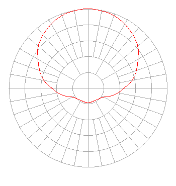
Directional Antenna
Antenna Make/Model: Jampro J3YF/1
Antenna ID: 120665
Polarization: H
| Primary Station |
| WPET(AM) |
Ch. 0 | Greensboro, North Carolina |
|
Structure Information
Structure Registration Number 1235239
Structure Type: TOWER
Registered To:
Truth Broadcasting Corporation
Structure Address:
South Eugene Street
Greensboro, NC
County Name: Guilford County
ASR Issued: 05/16/2023
Date Built: 05/29/2003
Site Elevation: 250 m (820 ft.)
Structure Height: 81.4 m (267 ft.)
Height Overall: 81.4 m (267 ft.)
Overall Height AMSL: 331.4 m (1087 ft.)
FAA Determination: 07/29/2002
FAA Study #: 02-ASO-3885-OE
FAA Circular #: 70/7460-1K
Paint & Light FAA Chapters: 4, 8, 12
Removed expiration date from determination. Scenario 1./jjs/case#635066
36-03-42.0 N 79-47-34.0 W (NAD 83)
36-03-41.5 N 79-47-34.9 W
(Converted to NAD 27)
|
W224CO(FX) Licensee Information
K-Love, Inc.
2000 Reams Fleming Boulevard
Franklin, TN 37064
Phone: 916-251-1600
Not-for-Profit | 0000184889 Applicant Information
Jon William Reeves
Title: Ceo
Date: 02/15/2022
Application Certifier
Educational Media Foundation
Educational Media Foundation
5700 West Oaks Blvd
Rocklin, CA 95765
Applicant
James L Travis
Educational Media Foundation
5700 West Oaks Blvd
Rocklin, CA 95765
FCC Compliance Engineer
Mary N O'Connor
Wilkinson Barker Knauer, LLP
1800 M Street, N.W.
Suite 800N
Washington, DC 20036
|