|
W269EC Channel: 269D 101.7 MHz
Dubois, Pennsylvania
Service: FX - A translator or application for a translator.
Facility ID: 85937
FRN: 0021206529
Fac. Service: FX
Programming Delivery Method: Unspecified
Status: LIC
Application Accepted: 02/16/2022
Application Granted: 02/24/2022
File Number: 0000184915
License Expires: 08/01/2030
Application Type: License To Cover
FCC Website Links:
LMS Facility Details
This Application
Other W269EC Applications
Including Superseded Applications
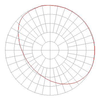
Service Contour - Open Street Map or USGS Map (60 dBu)
Service Contour - KML / Google Earth (60 dBu)
Facility Type: FM STATION
Class: D, A Noncommercial educational operating with no more than 10W
Site Location: 41-02-44.3 N 78-42-10.9 W (NAD 83)
Site Location: 41-02-44.1 N 78-42-11.8 W (Converted to NAD 27)
Effective Radiated Power: 0.25 kW
Transmitter Output Power: 0.721 kW
Antenna Center AMSL: 698.8 m (2293 ft.)
Antenna Center HAG: 73 m (240 ft.)
Site Elevation: 625.8 m. (2053 ft.)
Height Overall*: 86.9 m (285 ft.)
(* As Filed In This Application, may differ from ASR Data, Below.)
Directional Antenna
Antenna Make/Model: Nicom BKG77/1
Antenna ID: 35535
Polarization: H
| Primary Station |
| WCPA(AM) |
Ch. 0 | Clearfield, Pennsylvania |
|
Structure Information
Structure Registration Number 1265524
Structure Type: TOWER
Registered To:
GTC Uno, LLC
Structure Address:
Along Rt 219, 1 Mile East Of Luthersburg
Luthersburg, PA
County Name: Clearfield County
ASR Issued: 07/16/2024
Date Built: 10/09/2008
Site Elevation: 625.8 m (2053 ft.)
Structure Height: 86 m (282 ft.)
Height Overall: 86.9 m (285 ft.)
Overall Height AMSL: 712.7 m (2338 ft.)
FAA Determination: 11/28/2008
FAA Study #: 2008-AEA-4526-OE
FAA Circular #: 70/7460-1K
Paint & Light FAA Chapters: 4, 8, 12
OM&L to remain the same as prior study = A MED-DUAL SYSTEM
41-02-44.3 N 78-42-10.9 W (NAD 83)
41-02-44.1 N 78-42-11.8 W
(Converted to NAD 27)
|
W269EC(FX) Licensee Information
Southern Belle, LLC
115 West Main Street
Frankfort, KY 40601
Phone: 502-875-1130
Limited Liability Company | 0000184915 Applicant Information
Richard M Snavely, Jr
Title: President
Date: 02/16/2022
Application Certifier
Family Life Ministries, Inc.
Family Life Ministries, Inc.
PO Box 506
Bath, NY 14810
Applicant
Richard M Snavely, Jr
Family Life Ministries, Inc.
Bath, NY 14810
President
James L Travis
Family Life Ministries, Inc.
12372 Huckleberry Ct
Rancho Cucamonga, CA 91739
Consultant
|