|
W272DS Channel: 272D 102.3 MHz
Miami, Florida
Service: FX - A translator or application for a translator.
Facility ID: 90508
FRN: 0027049444
Fac. Service: FX
Programming Delivery Method: Unspecified
Status: LIC
Application Accepted: 11/09/2023
Application Granted: 11/14/2023
File Number: 0000225545
License Expires: 02/01/2028
Application Type: License To Cover
FCC Website Links:
LMS Facility Details
This Application
Other W272DS Applications
Including Superseded Applications
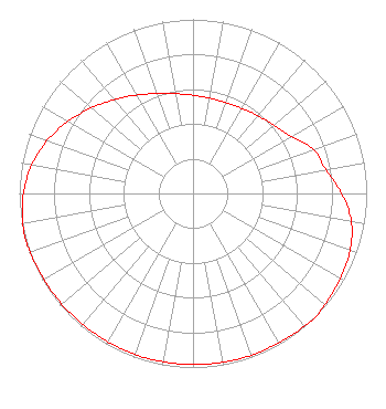
Service Contour - Open Street Map or USGS Map (60 dBu)
Service Contour - KML / Google Earth (60 dBu)
Facility Type: FM STATION
Class: D, A Noncommercial educational operating with no more than 10W
Site Location: 25-50-23.0 N 80-11-22.0 W (NAD 83)
Site Location: 25-50-21.7 N 80-11-22.8 W (Converted to NAD 27)
Effective Radiated Power: 0.013 kW
Transmitter Output Power: 0.048 kW
Antenna Center AMSL: 62.5 m (205 ft.)
Antenna Center HAG: 59.5 m (195 ft.)
Site Elevation: 3 m. (10 ft.)
Height Overall*: 63.2 m (207 ft.)
(* As Filed In This Application, may differ from ASR Data, Below.)
Directional Antenna
Antenna Make/Model: Nicom BKG77
Antenna ID: 1005767
Polarization: H
| Primary Station |
| WQVN(AM) |
Ch. 0 | North Miami, Florida |
|
Structure Information
Structure Registration Number 1020481
Structure Type: TOWER
Registered To:
Piment Bouk Radio, Inc.
Structure Address:
350 Ne 71st Street
Miami, FL
County Name: Miami-Dade County
ASR Issued: 03/24/2021
Date Built: 08/01/1987
Site Elevation: 3 m (10 ft.)
Structure Height: 62.3 m (204 ft.)
Height Overall: 63.2 m (207 ft.)
Overall Height AMSL: 66.2 m (217 ft.)
FAA Determination: 04/24/1997
FAA Study #: 97-ASO-1469-OE
FAA Circular #: 70/7460-1J
Paint & Light FAA Chapters: 3, 4, 5, 13
Removed expiration date from determination. Scenario 1./jjs/case#635066
25-50-23.0 N 80-11-22.0 W (NAD 83)
25-50-21.7 N 80-11-22.8 W
(Converted to NAD 27)
|
W272DS(FX) Licensee Information
Radio Piment Bouk, Inc.
46 NE 62nd Street
Miami, FL 33137
Phone: 786-487-7870
Corporation | 0000225545 Applicant Information
Nelson Voltaire
Title: President
Date: 11/09/2023
Application Certifier
Radio Piment Bouk
Radio Piment Bouk, Inc.
46 NE 62nd Street
Miami, FL 33137
Applicant
Charles A Hecht
Charles A Hecht & Associates, Inc.
19 Mackenzie Ct
Freehold, NJ 07728
John C. Trent, Esq.
Putbrese Hunsaker & Trent, P.C.
200 South Church Street
Woodstock, VA 22664
Counsel
|