Accept
By using FCCInfo you agree to the terms & conditions. Read disclaimer Read privacy statement
FCCInfo.com

A Service of Cavell, Mertz & Associates, Inc.
(855) FCC-INFO

K36QD-D
Call Sign History
K36QD-D from 09/09/2020
K21HS from 05/30/2006
K52ES from 10/23/1995
K63EE from 10/23/1995
890310A9 from ???
Channel 36DT

Omaha, NE
License
CP
Application
Allocation
STA


K36QD-D Service: LD - Digital TV Translator or LPTV Station
Channel: 36 Zone:
Omaha, Nebraska
DTV TSID: 10889
Facility ID: 68018
FRN: 0019813047

Status: APP
Application Accepted: 06/30/2025
License Expires: 06/01/2022
File Number: 0000274437

FCC Website Links:
  LMS Facility Details
  This Application
  Other K36QD-D Applications
  Including Superseded Applications
  Service Contour - Open Street Map or USGS Map (51 dBu)
  Service Contour - KML / Google Earth (51 dBu)
  Rabbit Ears Info Search for K36QD-D

Site Location: 41-04-29.3 N 96-15-24.0 W (NAD 83)
Site Location: 41-04-29.3 N 96-15-22.9 W (Converted to NAD 27)

ERP: 15 kW
Polarization: Horizontally polarized
R/C AGL: 71.2 m (234 ft.)
R/C AMSL: 462 m (1516 ft.)
Emission Mask: Full Service

Site Elevation: 390.8 m. (1282 ft.)
Height Overall*: 74.7 m (245 ft.)
(* As Filed In This Application, may differ from ASR Data, Below.)
Directional Antenna - Antenna Make/Model: DIELECTRIC DLP-12B
Antenna ID: 1012897
Polarization: Horizontally polarized

Primary Station
K36QD-D Ch. 36Omaha, Nebraska
Antenna Data for Antenna Id: 1012897
K36QD-D LD File: -0000274437
DIELECTRIC - DLP-12B
Service: LD
Standard Pattern: N
Pattern and Field Values Include a 225.0° Clockwise Rotation
AzimuthRatioAzimuthRatioAzimuthRatioAzimuthRatio
50.646150.662250.678350.689
450.692550.689650.678750.662
850.646950.6321050.6271150.633
1250.6531350.6861450.7291550.778
1650.8281750.8751850.9181950.953
2050.9792150.9952251.0002350.995
2450.9792550.9532650.9182750.875
2850.8282950.7783050.7293150.686
3250.6533350.6333450.6273550.632
Structure Information

Structure Registration Number 1030322
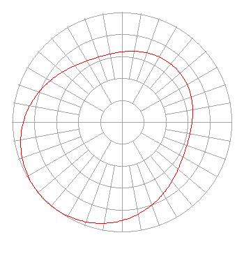
Structure Type: TOWER
Registered To:
American Towers LLC
Structure Address:
21800 Pflug Rd. (gretna Ne2 #88986)
Gretna, NE
County Name: Sarpy County
ASR Issued: 01/15/2013
Date Built: 11/28/1967
Site Elevation: 390.8 m (1282 ft.)
Structure Height: 68.9 m (226 ft.)
Height Overall: 74.7 m (245 ft.)
Overall Height AMSL: 465.5 m (1527 ft.)
FAA Determination: 12/30/2003
FAA Study #: 2003-ACE-2860-OE
FAA Circular #: 70/7460-1K
Paint & Light FAA Chapters: 4, 6, 12
PRIOR STUDY 2003-ACE-239-OE
41-04-29.3 N 96-15-24.0 W (NAD 83)
41-04-29.3 N 96-15-22.9 W
(Converted to NAD 27)
K36QD-D Licensee Information

Digital Networks-Midwest, LLC
Chattanooga, TN 37401
Phone: 423-468-5100
Limited Liability Company
0000274437 Applicant Information

Joel Wertman
Title: Coo
Date: 06/30/2025
Application Certifier
Digital Networks-Midwest, LLC
Chattanooga, TN 37401
Applicant
Timothy Z Sawyer
T Z Sawyer Technical Consultants
2130 Hutchison Grove Court
Suite 100
Falls Church, VA 22043
Technical Consultant
Aaron P Shainis
Shainis & Peltzman, Chartered
1850 M St. NW
Suite 240
Washington, DC 20036
FCC Legal Counsel
Associated Land Mobile Licenses


(No Records Found)
Associated Microwave Licenses


(No Records Found)

Study Date: 7/02/2025; Study Duration: 0.0935 Seconds.
Database Sources:
07/02/2025 FCC LMS,
7/1/2025 FCC ASR,
7/1/2025 FCC ULS Microwave, and
7/1/2025 FCC ULS Broadcast Land Mobile.


© 2025 Capitol Airspace Group, LLC.
Alexandria, Virginia


If you have questions or concerns about the station above please contact the station Licensee.
Comments and questions about FCCInfo can be emailed to: webmaster@fccinfo.com