|
WKWM Channel: 218C3 91.5 MHz
Marathon, Florida
Service: FM - A full-service FM station or application.
Facility ID: 122606
FRN: 0004998118
Fac. Service: FM Analog & Digital
Status: LIC
Application Accepted: 08/19/2008
Application Granted: 08/25/2008
File Number: BLED-20080819AAB
License Expires: 02/01/2028
Prefix Type: This is a license for a noncommercial educational FM station
Application Type: License To Cover
FCC Website Links:
LMS Facility Details
This Application
Other WKWM Applications
Including Superseded Applications
Service Contour - Open Street Map or USGS Map (60 dBu)
Service Contour - KML / Google Earth (60 dBu)
Public Inspection Files
Facility Type: NON-COMMERCIAL EDUC. FM
Class: C3, A Zone II station; with 6kW-25kW ERP and a class contour distance 28km-39km
Site Location: 24-39-41.5 N 81-25-09.3 W (NAD 83)
Site Location: 24-39-40.0 N 81-25-10.0 W (Converted to NAD 27)
Effective Radiated Power: 12 kW
Transmitter Output Power: 1.815 kW
Antenna Center HAAT: 140.8 m (462 ft.)
Antenna Center AMSL: 140.8 m (462 ft.)
Antenna Center HAG: 139.6 m (458 ft.)
Calculated Site Elevation: 1.2 m. (4 ft.)
Height Overall*: 152.4 m (500 ft.)
(* As Filed In This Application, may differ from ASR Data, Below.)
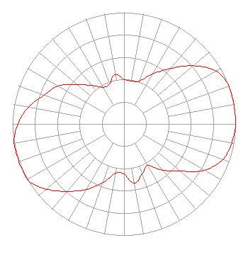
Directional Antenna
Antenna Make/Model: Shivley 6014-8/2-0.90SS-DA, 8 sections 0.8 spacing
Antenna ID: 79130
Polarization:
| Associated Translators |
| W221AY(FX) |
Ch. 221 | Tavernier, Florida |
|
Structure Information
Structure Registration Number 1261685
Structure Type: TOWER
Registered To:
Global Tower, LLC. through American Towers, LLC
Structure Address:
400' N Of Us 1 Highway, Ramrod Key
Ramrod Key, FL
County Name: Monroe County
ASR Issued: 08/29/2014
Date Built: 12/20/2008
Site Elevation: 1 m (3 ft.)
Structure Height: 152.1 m (499 ft.)
Height Overall: 152.1 m (499 ft.)
Overall Height AMSL: 153.1 m (502 ft.)
FAA Determination: 12/14/2007
FAA Study #: 2007-ASO-6514-OE
FAA Circular #: 70/7460-1K
Paint & Light FAA Chapters: 4, 8, 12
Removed expiration date from determination. Scenario 1./jjs/case#635066
24-39-41.3 N 81-25-09.7 W (NAD 83)
24-39-39.8 N 81-25-10.4 W
(Converted to NAD 27)
|
WKWM(FM) Licensee Information
The School Board of Miami - Dade County, FL
172 NE 15th St
Miami, FL 33132
Phone: 305-995-4502
Government Entity | 20080819AAB Applicant Information
John Labonia
Date: 08/19/2008
Application Certifier
The School Board of Miami-Dade County, Florida
172 Northeast 15th Street
Miami, FL 33132
Applicant
Ryan C. Wilhour
Kessler and Gehman Associates, Inc.
507 NW 60th Street, Suite C
Gainesville, FL 32607
Consulting Engineer
Joseph A. Belisle
Leibowitz & Associates
|