Accept
By using FCCInfo you agree to the terms & conditions. Read disclaimer Read privacy statement
FCCInfo.com

A Service of Cavell, Mertz & Associates, Inc.
(855) FCC-INFO

WHBT-FM
Call Sign History
WHBT-FM from 01/22/2015
WKSA from 10/27/2010
WCDG from 03/09/2004
WBHH from 02/02/2001
WSVV from 09/05/1997
WMYK from 07/22/1991
WTZR from 08/01/1990
WOFM from 08/01/1990
92.1 MHz

Moyock, NC
License
CP
Application
Allocation
STA


WHBT-FM Channel: 221C3 92.1 MHz
Moyock, North Carolina
Service: FM - A full-service FM station or application.
Facility ID: 70345
FRN: 0014042816
Fac. Service: FM Analog & Digital

Status: LIC
73.215 Station
Application Accepted: 07/20/2005
Application Granted: 02/28/2006
File Number: BMLH-20050720AEW
License Expires: 12/01/2027
Prefix Type: This is a modification of a license for a commecial FM station
Application Type: Minor Modification

FCC Website Links:
  LMS Facility Details
  This Application
  Other WHBT-FM Applications
  Including Superseded Applications
  Service Contour - Open Street Map or USGS Map (60 dBu)
  Service Contour - KML / Google Earth (60 dBu)
  Public Inspection Files

Facility Type: FM STATION
Class: C3, A Zone II station; with 6kW-25kW ERP and a class contour distance 28km-39km

Site Location: 36-37-38.5 N 76-13-05.8 W (NAD 83)
Site Location: 36-37-38.0 N 76-13-07.0 W (Converted to NAD 27)

Effective Radiated Power: 14.5 kW
Transmitter Output Power: 9.75 kW
Antenna Center HAAT: 131 m (430 ft.)
Antenna Center AMSL: 131 m (430 ft.)
Antenna Center HAG: 127 m (417 ft.)

Calculated Site Elevation: 4 m. (13 ft.)
Height Overall*: 130 m (427 ft.)
(* As Filed In This Application, may differ from ASR Data, Below.)
Directional Antenna
Antenna Make/Model: Shivley 6810-2-DA
Antenna ID: 14493
Polarization:

Antenna Data for Antenna Id: 14493
WHBT-FM FM File: BMLH-20050720AEW
Shivley - 6810-2-DA
Service: FM
AzimuthRatioAzimuthRatioAzimuthRatioAzimuthRatio
00.940100.970201.000301.000
401.000501.000601.000700.970
800.930900.8801000.8201100.780
1200.7401300.7201400.7201500.740
1600.7801700.8201800.8801900.930
2000.9702101.0002201.0002301.000
2401.0002501.0002600.9702700.940
2800.9002900.8603000.8403100.810
3200.8103300.8403400.8603500.900
Structure Information

Structure Registration Number 1026211

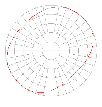
[ASR Heights Differ from WHBT-FM Application]
Structure Type: TOWER
Registered To:
VB-S1 Assets, LLC
Structure Address:
400 Hickory Ridge Rd
Chesapeake, VA
County Name: Chesapeake city
ASR Issued: 08/02/2024
Date Built: 06/11/1997
Site Elevation: 5.8 m (19 ft.)
Structure Height: 128.6 m (422 ft.)
Height Overall: 129.5 m (425 ft.)
Overall Height AMSL: 135.3 m (444 ft.)
FAA Determination: 07/05/2003
FAA Study #: 2003-AEA-1881-OE
FAA Circular #: 70/7460-1J
Paint & Light FAA Chapters: 3, 4, 5, 13
PRIOR STUDY 1997-AEA-917-OE
36-37-39.3 N 76-13-06.1 W (NAD 83)
36-37-38.8 N 76-13-07.3 W
(Converted to NAD 27)
WHBT-FM Licensee Information

IHM Licenses, LLC
7136 S. Yale Avenue
Suite 501
Tulsa, OK 74136
Phone: 918-664-4581
Limited Liability Company
20050720AEW Applicant Information

Stephen G. Davis
Date: 07/20/2005
Application Certifier
Clear Channel Broadcasting Licenses, Inc.
2625 S. Memorial Drive
Suite A
Tulsa, OK 74129
Applicant
Jeffrey G Frey
2625 S Memorial Drive
Suite A
Tulsa, OK 74129
FCC Engineer
Marissa G. Repp
Hogan & Hartson L.L.P.

Associated Land Mobile Licenses


(No Records Found)
Associated Microwave Licenses


 WQRM401 950 MHz Aural Studio Transmitter Link

Study Date: 4/30/2025; Study Duration: 0.1403 Seconds.
Database Sources:
04/30/2025 FCC LMS,
4/29/2025 FCC ASR,
4/29/2025 FCC ULS Microwave, and
4/29/2025 FCC ULS Broadcast Land Mobile.


© 2025 Capitol Airspace Group, LLC.
Alexandria, Virginia


If you have questions or concerns about the station above please contact the station Licensee.
Comments and questions about FCCInfo can be emailed to: webmaster@fccinfo.com