|
W232CM Channel: 232D 94.3 MHz
Wauseon, Ohio
Service: FX - A translator or application for a translator.
Facility ID: 142063
FRN: 0002944304
Fac. Service: FX
Programming Delivery Method: Unspecified
Status: LIC
Application Accepted: 09/07/2018
Application Granted: 09/12/2018
File Number: BLFT-20180907AAI
License Expires: 10/01/2028
Prefix Type: This is a license for a translator
Application Type: License To Cover
FCC Website Links:
LMS Facility Details
This Application
Other W232CM Applications
Including Superseded Applications
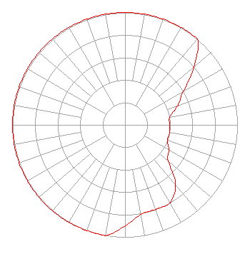
Service Contour - Open Street Map or USGS Map (60 dBu)
Service Contour - KML / Google Earth (60 dBu)
Class: D, A Noncommercial educational operating with no more than 10W
Site Location: 41-33-29.2 N 84-11-07.8 W (NAD 83)
Site Location: 41-33-29.0 N 84-11-08.0 W (Converted to NAD 27)
Effective Radiated Power: 0.13 kW
Transmitter Output Power: 0.382 kW
Antenna Center AMSL: 303 m (994 ft.)
Antenna Center HAG: 67 m (220 ft.)
Site Elevation: 236 m. (774 ft.)
Height Overall*: 117 m (384 ft.)
(* As Filed In This Application, may differ from ASR Data, Below.)
Directional Antenna
Antenna Make/Model: NIC BKG1/P-1DA(SLANT45)
Antenna ID: 132136
Polarization:
| Primary Station |
| WMTR-FM |
Ch. 241 | Archbold, Ohio |
|
Structure Information
Structure Registration Number 1038620
Structure Type: GTOWER
Registered To:
NOBCO INC.
Structure Address:
753 Township Road W21
Wauseon, OH
County Name: Fulton County
ASR Issued: 11/21/2016
Date Built: 12/15/1988
Site Elevation: 236.3 m (775 ft.)
Structure Height: 115.8 m (380 ft.)
Height Overall: 116.7 m (383 ft.)
Overall Height AMSL: 353 m (1158 ft.)
FAA Determination: 07/14/1988
FAA Study #: 88-AGL-627-OE
FAA Circular #: 70/7460-1G
Paint & Light FAA Chapters: 3, 4, 5, 9
41-33-29.1 N 84-11-07.8 W (NAD 83)
41-33-28.9 N 84-11-08.0 W
(Converted to NAD 27)
|
W232CM(FX) Licensee Information
Nobco, Inc.
303 1/2 North Defiance St.
Archbold, OH 43502-1162
Phone: 419-445-9050
| 20180907AAI Applicant Information
Max E. Smith, Jr.
Date: 09/07/2018
Application Certifier
Nobco, Inc.
303 1/2 North Defiance St.
Archbold, OH 43502
Applicant
Justin Asher
Asher Broadcast Consulting, LLC
579 Babcock Road
Bronson, MI 49028-9347
Technical Consultant
Marissa G. Repp, Esq.
Repp Law Firm
1629 K Street, NW
Suite 300
Washington, DC 20006-1631
|