|
WVGR Channel: 281B 104.1 MHz
Grand Rapids, Michigan
Service: FM - A full-service FM station or application.
Facility ID: 66309
FRN: 0003927902
Fac. Service: FM Analog & Digital
Status: LIC
Application Accepted: 03/06/2008
Application Granted: 03/21/2008
File Number: BMLED-20080306ABQ
License Expires: 10/01/2028
Prefix Type: This is a modification of license for a noncommercial educational FM station
Application Type: Minor Modification
FCC Website Links:
LMS Facility Details
This Application
Other WVGR Applications
Including Superseded Applications
Service Contour - Open Street Map or USGS Map (54 dBu)
Service Contour - KML / Google Earth (54 dBu)
Public Inspection Files
Facility Type: NON-COMMERCIAL EDUC. FM
Class: B, A Zone I or I-A station; with 25kW-50kW ERP and a class contour distance 39km-52km
Site Location: 42-39-17.1 N 85-31-38.1 W (NAD 83)
Site Location: 42-39-17.0 N 85-31-38.0 W (Converted to NAD 27)
Effective Radiated Power: 96 kW
Transmitter Output Power: 18.11 kW
Antenna Center HAAT: 221 m (725 ft.)
Antenna Center AMSL: 469 m (1539 ft.)
Antenna Center HAG: 227.5 m (746 ft.)
Site Elevation: 241.5 m. (792 ft.)
Height Overall*: 239.8 m (787 ft.)
(* As Filed In This Application, may differ from ASR Data, Below.)
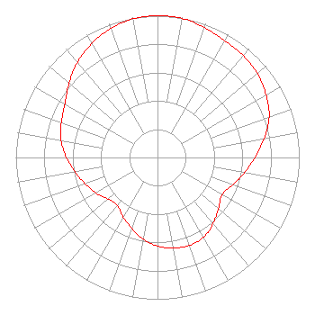
Directional Antenna
Antenna Make/Model: DIELECTRIC DCRC6EHD, six sections
Antenna ID: 75841
Polarization:
|
Structure Information
Structure Registration Number 1243207
Structure Type: GTOWER
Registered To:
Regents of The University of Michigan
Structure Address:
165 N. Payne Lake Rd. Wayland Mi. 49348
Wayland, MI
County Name: Barry County
ASR Issued: 12/04/2017
Date Built: 12/14/2017
Site Elevation: 241.5 m (792 ft.)
Structure Height: 219.4 m (720 ft.)
Height Overall: 239.8 m (787 ft.)
Overall Height AMSL: 481.3 m (1579 ft.)
FAA Determination: 10/25/2017
FAA Study #: 2017-AGL-18597-OE
FAA Circular #: 70/7460-1L
Paint & Light FAA Chapters: 3, 4, 5, 12
PRIOR STUDY 2006-AGL-6357-OE
42-39-17.5 N 85-31-38.0 W (NAD 83)
42-39-17.4 N 85-31-37.9 W
(Converted to NAD 27)
|
WVGR(FM) Licensee Information
Regents of the University of Michigan
535 W. William Street
Suite 110
Ann Arbor, MI 48103
Phone: 734-764-9210
Government Entity | 20080306ABQ Applicant Information
Timothy P. Slottow
Date: 03/06/2008
Application Certifier
Regents of the University of Michigan
535 W. William Street
Ann Arbor, MI 48103
Applicant
Robert Skon
535 W. William St.
Ann Arbor, MI 48103
Chief Engineer
Todd D. Gray
Dow, Lohnes & Albertson
|