|
W274BM Channel: 274D 102.7 MHz
Peoria, Illinois
Service: FX - A translator or application for a translator.
Facility ID: 149364
FRN: 0002711737
Fac. Service: FX
Programming Delivery Method: Unspecified
Status: LIC
Application Accepted: 04/01/2013
Application Granted: 05/07/2013
File Number: BLFT-20130401AFP
License Expires: 12/01/2028
Prefix Type: This is a license for a translator
Application Type: License To Cover
FCC Website Links:
LMS Facility Details
This Application
Other W274BM Applications
Including Superseded Applications
Service Contour - Open Street Map or USGS Map (60 dBu)
Service Contour - KML / Google Earth (60 dBu)
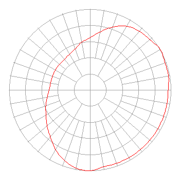
Class: D, A Noncommercial educational operating with no more than 10W
Site Location: 40-38-53.1 N 89-33-26.3 W (NAD 83)
Site Location: 40-38-53.0 N 89-33-25.9 W (Converted to NAD 27)
Effective Radiated Power: 0.25 kW
Transmitter Output Power: 0.8 kW
Antenna Center AMSL: 298 m (978 ft.)
Antenna Center HAG: 100 m (328 ft.)
Site Elevation: 198 m. (650 ft.)
Height Overall*: 152 m (499 ft.)
(* As Filed In This Application, may differ from ASR Data, Below.)
Directional Antenna
Antenna Make/Model: NIC BKG77
Antenna ID: 112203
Polarization:
| Primary Station |
| WPBG(FM) |
Ch. 227 | Peoria, Illinois |
|
Structure Information
Structure Registration Number 1247127
Structure Type: GTOWER
Registered To:
Illinois Central Radio Fellowship Inc.
Structure Address:
Wooded Area Near End Of Highpoint (a South Frontage Road To I-74)
Near East Peoria, IL
County Name: Tazewell County
ASR Issued: 04/10/2014
Date Built: 03/22/2006
Site Elevation: 198 m (650 ft.)
Structure Height: 150 m (492 ft.)
Height Overall: 152 m (499 ft.)
Overall Height AMSL: 350 m (1148 ft.)
FAA Determination: 04/08/2013
FAA Study #: 2013-AGL-1294-OE
FAA Circular #: 70/7460-1K
Paint & Light FAA Chapters: 4, 6, 12
PRIOR STUDY 2004-AGL-7661-OE CHAPTERS 4,6,12 (1K) ADD SPECIAL CONDITION FOR LIGHTING DEVIATION
40-38-53.0 N 89-33-26.0 W (NAD 83)
40-38-52.9 N 89-33-25.6 W
(Converted to NAD 27)
|
W274BM(FX) Licensee Information
Midwest Communications, Inc.
904 Grand Ave.
Wausau, WI 54403
Phone: 000-000-0000
Corporation | 20130401AFP Applicant Information
Brian Emkjer
Date: 04/01/2013
Application Certifier
Monterey Licenses, LLC
2511 Garden Road
Building A, Suite 104
Monterey, CA 93940
Applicant
Jim Turvaville
Turbo Technical Services
4825-104 Garden Ranch Drive
Colorado Springs, CO 80918
Consulting Engineer
David Oxenford
Wilkinson Barker Knauer, LLP
2300 N Street, N.W.
Suite 700
Washington, DC 20037-1128
|