
FCCInfo.com
A Service of Cavell, Mertz & Associates, Inc.
(855) FCC-INFO
|
|
|
|
|
||||||||||||||||
|
|
W259BW Channel: 259D 99.7 MHz Canton, Ohio Service: FX - A translator or application for a translator. Facility ID: 144998 Fac. Service: FX Programming Delivery Method: Unspecified Status: License Application Accepted: 05/23/2014 Application Granted: 06/23/2014 File Number: BLFT-20140523ABC License Expires: 00/00/0000 Prefix Type: This is a license for a translator Application Type: License To Cover FCC Website Links: LMS Facility Details This Application CDBS Application Other W259BW Applications Other W259BW Applications in CDBS Including Superseded Applications Mailing Address Correspondence for W259BW Correspondence related to application BLFT-20140523ABC Service Contour - Open Street Map or USGS Map (60 dBu) Service Contour - KML / Google Earth (60 dBu) Class: D, A Noncommercial educational operating with no more than 10W Site Location: 40-49-22.0 N 81-25-40.0 W (NAD 83) Site Location: 40-49-21.8 N 81-25-40.6 W (Converted to NAD 27) Effective Radiated Power: 0.25 kW Transmitter Output Power: 0.11 kW Antenna Center HAAT: 0 m Antenna Center AMSL: 400 m (1312 ft.) Antenna Center HAG: 67 m (220 ft.) Site Elevation: 333 m. (1093 ft.) Height Overall*: 113 m (371 ft.) (* As Filed In This Application, may differ from ASR Data, Below.) Directional Antenna Antenna Make/Model: None Antenna ID: 117093 Polarization:
| ||||||||||||||||||
| Antenna Data for Antenna Id: 117093 W259BW FX File: BLFT-20140523ABC None - Service: FX | 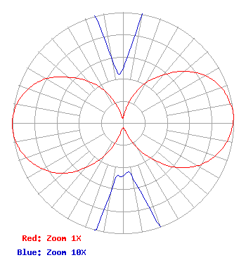 | ||||||||||||||||||
| Azimuth | Ratio | Azimuth | Ratio | Azimuth | Ratio | Azimuth | Ratio | ||||||||||||
| 0 | 0.049 | 10 | 0.101 | 20 | 0.261 | 30 | 0.423 | ||||||||||||
| 40 | 0.566 | 50 | 0.726 | 60 | 0.858 | 70 | 0.943 | ||||||||||||
| 80 | 0.985 | 85 | 1.000 | 90 | 0.993 | 100 | 0.956 | ||||||||||||
| 110 | 0.883 | 120 | 0.774 | 130 | 0.626 | 140 | 0.438 | ||||||||||||
| 150 | 0.268 | 160 | 0.105 | 170 | 0.050 | 180 | 0.048 | ||||||||||||
| 190 | 0.062 | 200 | 0.181 | 210 | 0.351 | 220 | 0.527 | ||||||||||||
| 230 | 0.711 | 240 | 0.834 | 250 | 0.927 | 260 | 0.983 | ||||||||||||
| 270 | 1.000 | 280 | 0.974 | 290 | 0.907 | 300 | 0.801 | ||||||||||||
| 310 | 0.642 | 320 | 0.495 | 330 | 0.342 | 340 | 0.175 | ||||||||||||
| 350 | 0.060 | ||||||||||||||||||
Structure Registration Number 1242890 [ASR Heights Differ from W259BW Application] Structure Type: GTOWER Registered To: Vertical Bridge CC FM, LLC Structure Address: 4536 22nd St. N.w. (us-oh-5049) Canton, OH County Name: Stark County ASR Issued: 12/19/2018 Date Built: 12/28/2006 Site Elevation: 334.7 m (1098 ft.) Structure Height: 111.9 m (367 ft.) Height Overall: 113.7 m (373 ft.) Overall Height AMSL: 448.4 m (1471 ft.) FAA Determination: 09/07/2017 FAA Study #: 2017-AGL-15605-OE FAA Circular #: 70/7460-1L Paint & Light FAA Chapters: 4, 8, 12 PRIOR STUDY 2015-AGL-9147-OE 40-49-22.0 N 81-25-40.0 W (NAD 83) 40-49-21.8 N 81-25-40.6 W (Converted to NAD 27) |
7136 S. Yale Avenue Suite 501 Tulsa, OK 74136 Phone: 918-664-4581 | Date: 05/23/2014 Application Certifier CAPSTAR TX, LLC 7136 S. Yale Avenue Suite 501 Tulsa, OK 74136 Applicant TROY LANGHAM 2625 S Memorial Drive Suite A Tulsa, OK 74129 FCC ENGINEERING SUPERVISOR TROY LANGHAM Clear Channel 2625 S. Memorial Drive Suite A Tulsa, OK 74129 | |||||||||||||||||