
FCCInfo.com
A Service of Cavell, Mertz & Associates, Inc.
(855) FCC-INFO
|
|
|
Virtual Channel 51 |  |
|
|||||||||||||||||||||||||||
|
|
Status: Construction Permit Application Accepted: 04/25/2013 KOHD CP Expires: 02/01/2023 File Number: BDRTCDT-20130425AAK Prefix Type: This is BDRTCDT FCC Website Links: LMS Facility Details This Application Other KOHD Applications Including Superseded Applications Mailing Address Correspondence for KOHD Correspondence related to application BDRTCDT-20130425AAK Service Contour - Open Street Map or USGS Map (51 dBu) Service Contour - KML / Google Earth (51 dBu) Rabbit Ears Info Search for KOHD Site Location: 43-52-24.4 N 121-30-15.1 W (NAD 83) Site Location: 43-52-25.0 N 121-30-11.0 W (Converted to NAD 27) ERP: 0.66 kW R/C AGL: 15 m (49 ft.) R/C AMSL: 1516 m (4974 ft.) Emission Mask: Stringent Site Elevation: 1501 m. (4925 ft.) Height Overall*: 16.8 m (55 ft.) (* As Filed In This Application, may differ from ASR Data, Below.) Directional Antenna - Antenna Make/Model: Scala CL1469 Antenna ID: 114148
| ||||||||||||||||||||||||||||||
| Antenna Data for Antenna Id: 114148 KOHD LD File: BDRTCDT-20130425AAK Scala - CL1469 Service: LD Standard Pattern: Y | 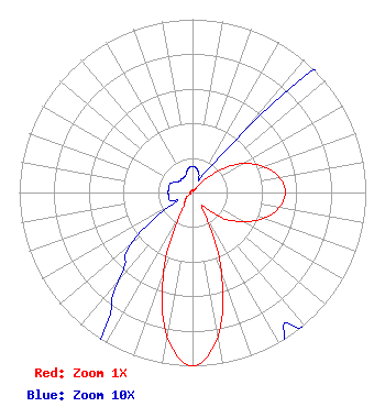 | ||||||||||||||||||||||||||||||
| Azimuth | Ratio | Azimuth | Ratio | Azimuth | Ratio | Azimuth | Ratio | ||||||||||||||||||||||||
| 0 | 0.015 | 10 | 0.014 | 20 | 0.011 | 30 | 0.010 | ||||||||||||||||||||||||
| 40 | 0.047 | 50 | 0.195 | 60 | 0.335 | 70 | 0.437 | ||||||||||||||||||||||||
| 80 | 0.508 | 90 | 0.536 | 100 | 0.508 | 110 | 0.437 | ||||||||||||||||||||||||
| 120 | 0.335 | 130 | 0.232 | 140 | 0.107 | 150 | 0.137 | ||||||||||||||||||||||||
| 160 | 0.490 | 170 | 0.844 | 180 | 1.000 | 190 | 0.844 | ||||||||||||||||||||||||
| 200 | 0.490 | 210 | 0.137 | 220 | 0.067 | 230 | 0.047 | ||||||||||||||||||||||||
| 240 | 0.012 | 250 | 0.014 | 260 | 0.014 | 270 | 0.014 | ||||||||||||||||||||||||
| 280 | 0.014 | 290 | 0.014 | 300 | 0.012 | 310 | 0.010 | ||||||||||||||||||||||||
| 320 | 0.010 | 330 | 0.010 | 340 | 0.011 | 350 | 0.014 | ||||||||||||||||||||||||
Structure Registration Number 1249718 Structure Type: POLE Registered To: NPG of Oregon, Inc. Structure Address: Spring River Butte Sunriver, OR County Name: Deschutes County ASR Issued: 05/11/2015 Date Built: 01/01/1980 Site Elevation: 1501.1 m (4925 ft.) Structure Height: 16.8 m (55 ft.) Height Overall: 16.8 m (55 ft.) Overall Height AMSL: 1517.9 m (4980 ft.) FAA Determination: 08/09/2005 FAA Study #: 2005-ANM-1376-OE Paint & Light FAA Chapters: NONE 43-52-24.4 N 121-30-15.1 W (NAD 83) 43-52-25.0 N 121-30-11.0 W (Converted to NAD 27) |
525 Junction Road Madison, WI 53717 Phone: 608-664-4000 Limited Liability Company | Date: 04/25/2013 Application Certifier THREE SISTERS BROADCASTING, LLC Po Box 7009 Springfield, OR 97475 Applicant B. W. ST. CLAIR 2355 Ranch Drive Westminster, CO 80234 ENGINEERING CONSULTANT SHELLEY SADOWSKY, ESQ. Dickstein Shapiro Llp 1825 Eye St., Nw Washington, DC 20006 | |||||||||||||||||||||||||||||