
FCCInfo.com
A Service of Cavell, Mertz & Associates, Inc.
(855) FCC-INFO
|
|
W32EI-D from 11/07/2012 W32EI-D from 02/25/2004 |
|
|
||||||||||||||||
|
|
W32EI-D is a channel sharing guest of W33ET-D, New York, New York Status: License Application Accepted: 10/07/2016 License Expires: 06/01/2023 File Number: -0000015198 FCC Website Links: LMS Facility Details This Application Other W32EI-D Applications Including Superseded Applications Mailing Address Correspondence for W32EI-D Correspondence related to application -0000015198 Service Contour - Open Street Map or USGS Map (51 dBu) Service Contour - KML / Google Earth (51 dBu) Rabbit Ears Info Search for W32EI-D Site Location: 41-00-35.6 N 74-35-37.4 W (NAD 83) Site Location: 41-00-35.2 N 74-35-38.8 W (Converted to NAD 27) ERP: 1.87 kW Polarization: Horizontally polarized R/C AGL: 65.5 m (215 ft.) R/C AMSL: 471.5 m (1547 ft.) Emission Mask: Full Service Site Elevation: 406 m. (1332 ft.) Height Overall*: 85.6 m (281 ft.) (* As Filed In This Application, may differ from ASR Data, Below.) Directional Antenna - Antenna Make/Model: MICRO COMMUNICATIONS INC 955318 Antenna ID: 20061 Polarization: Horizontally polarized | ||||||||||||||||||
| Antenna Data for Antenna Id: 20061 W32EI-D LD File: -0000015198 MICRO COMMUNICATIONS INC - 955318 Service: LD Standard Pattern: Y Pattern and Field Values Include a 11° Clockwise Rotation | 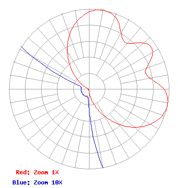 | ||||||||||||||||||
| Azimuth | Ratio | Azimuth | Ratio | Azimuth | Ratio | Azimuth | Ratio | ||||||||||||
| 1 | 0.967 | 11 | 1.000 | 21 | 0.947 | 31 | 0.793 | ||||||||||||
| 36 | 0.740 | 41 | 0.756 | 51 | 0.902 | 56 | 0.933 | ||||||||||||
| 61 | 0.902 | 71 | 0.756 | 76 | 0.740 | 81 | 0.793 | ||||||||||||
| 91 | 0.947 | 101 | 1.000 | 111 | 0.967 | 121 | 0.872 | ||||||||||||
| 131 | 0.729 | 141 | 0.556 | 151 | 0.378 | 161 | 0.218 | ||||||||||||
| 171 | 0.094 | 181 | 0.021 | 191 | 0.010 | 201 | 0.010 | ||||||||||||
| 211 | 0.010 | 221 | 0.010 | 231 | 0.010 | 241 | 0.010 | ||||||||||||
| 251 | 0.010 | 261 | 0.010 | 271 | 0.010 | 281 | 0.010 | ||||||||||||
| 291 | 0.021 | 301 | 0.094 | 311 | 0.218 | 321 | 0.378 | ||||||||||||
| 331 | 0.556 | 341 | 0.729 | 351 | 0.872 | ||||||||||||||
Structure Registration Number 1032928 Structure Type: LTOWER Registered To: American Towers LLC Structure Address: Weldon Road (092873 / Mci Sparta Nj) Sparta, NJ County Name: Sussex County ASR Issued: 01/18/2016 Date Built: 06/09/2009 Site Elevation: 406 m (1332 ft.) Structure Height: 83.8 m (275 ft.) Height Overall: 85.6 m (281 ft.) Overall Height AMSL: 491.6 m (1613 ft.) FAA Determination: 03/10/2015 FAA Study #: 2015-AEA-583-OE FAA Circular #: 70/7460-1K Paint & Light FAA Chapters: 4, 6, 12 PRIOR STUDY 2013-AEA-1556-OE 41-00-35.6 N 74-35-37.4 W (NAD 83) 41-00-35.2 N 74-35-38.8 W (Converted to NAD 27) |
2383 Pruneridge Avenue Suite 4 Santa Clara, CA 95050 Phone: 415-886-7284 Corporation | Title: Manager Date: 10/07/2016 Application Certifier Venture Technologies Group, Llc 5670 Wilshire Blvd., Suite 1300 Los Angeles, CA 90036 Applicant LAWRENCE ROGOW Venture Technologies Group, Llc 5670 Wilshire Blvd. Suite 1300 Los Angeles, CA 90036 JOAN STEWART Wiley Rein Llp 1776 K Street Nw Washington, DC 20006 | |||||||||||||||||