
FCCInfo.com
A Service of Cavell, Mertz & Associates, Inc.
(855) FCC-INFO
|
|
KXBF-LD from 02/25/2010 |
|
|
||||||||||||||||
|
|
Status: License Application Accepted: 08/21/2013 License Expires: 12/01/2022 File Number: BLDTL-20130821ACC Prefix Type: This is BLDTL FCC Website Links: LMS Facility Details This Application Other KXBF-LD Applications Including Superseded Applications Mailing Address Correspondence for KXBF-LD Correspondence related to application BLDTL-20130821ACC Service Contour - Open Street Map or USGS Map (51 dBu) Service Contour - KML / Google Earth (51 dBu) Rabbit Ears Info Search for KXBF-LD Site Location: 35-21-03.3 N 118-53-45.9 W (NAD 83) Site Location: 35-21-03.4 N 118-53-42.5 W (Converted to NAD 27) ERP: 1 kW R/C AGL: 30 m (98 ft.) R/C AMSL: 176.3 m (578 ft.) Emission Mask: Stringent Site Elevation: 146.3 m. (480 ft.) Height Overall*: 47.6 m (156 ft.) (* As Filed In This Application, may differ from ASR Data, Below.) Directional Antenna - Antenna Make/Model: MICRO COMMUNICATIONS INC 955512 Antenna ID: 20067 | ||||||||||||||||||
| Antenna Data for Antenna Id: 20067 KXBF-LD LD File: BLDTL-20130821ACC MICRO COMMUNICATIONS INC - 955512 Service: LD Standard Pattern: Y Pattern and Field Values Include a 275° Clockwise Rotation | 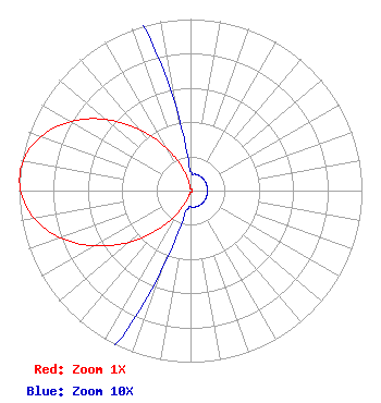 | ||||||||||||||||||
| Azimuth | Ratio | Azimuth | Ratio | Azimuth | Ratio | Azimuth | Ratio | ||||||||||||
| 5 | 0.010 | 15 | 0.010 | 25 | 0.010 | 35 | 0.010 | ||||||||||||
| 45 | 0.010 | 55 | 0.010 | 65 | 0.010 | 75 | 0.010 | ||||||||||||
| 85 | 0.010 | 95 | 0.010 | 105 | 0.010 | 115 | 0.010 | ||||||||||||
| 125 | 0.010 | 135 | 0.010 | 145 | 0.010 | 155 | 0.010 | ||||||||||||
| 165 | 0.010 | 175 | 0.010 | 185 | 0.010 | 195 | 0.021 | ||||||||||||
| 205 | 0.094 | 215 | 0.218 | 225 | 0.378 | 235 | 0.556 | ||||||||||||
| 245 | 0.729 | 255 | 0.872 | 265 | 0.967 | 275 | 1.000 | ||||||||||||
| 285 | 0.967 | 295 | 0.872 | 305 | 0.729 | 315 | 0.556 | ||||||||||||
| 325 | 0.378 | 335 | 0.218 | 345 | 0.094 | 355 | 0.021 | ||||||||||||
Structure Registration Number 1055728 Structure Type: LTOWER Registered To: American Towers LLC Structure Address: Ne Corner Of Hwy 58, Vineland Road (hwy 99/vineland #8325) Bakersfield, CA County Name: Kern County ASR Issued: 08/30/2022 Date Built: 01/01/1998 Site Elevation: 146.3 m (480 ft.) Structure Height: 43 m (141 ft.) Height Overall: 47.6 m (156 ft.) Overall Height AMSL: 193.9 m (636 ft.) FAA Determination: 08/26/2022 FAA Study #: 2022-AWP-4608-OE Paint & Light FAA Chapters: NONE PRIOR STUDY 2013-AWP-2644-OE 35-21-03.3 N 118-53-45.9 W (NAD 83) 35-21-03.4 N 118-53-42.5 W (Converted to NAD 27) |
295 Madison Avenue, 12th Floor New York, NY 10017 Phone: 954-606-5486 Corporation | Date: 08/21/2013 Application Certifier JILYNN M. ERNANDES P.o. Box 923 Folsom, CA 95763 Applicant FRANK ERNANDES P.o. Box 923 Folsom, CA 95763 ENGINEER MARNIE K. SARVER Wiley Rein Llp | |||||||||||||||||