Accept
By using FCCInfo you agree to the terms & conditions. Read disclaimer Read privacy statement
FCCInfo.com

A Service of Cavell, Mertz & Associates, Inc.
(855) FCC-INFO

KCWO-TV
Call Sign History
KCWO-TV from 01/01/2019
KCWO-TV from 04/19/1999
Channel 33DT
Virtual Channel 4

Big Spring, TX
License
CP
Application
Allocation
STA


KCWO-TV Service: DT - Digital TV
Channel: 33 Zone: 2
Big Spring, Texas
Nielsen DMA™:  Odessa - Midland
Network: CW PLUS
Virtual Channel: 4
DTV TSID: 2775
Facility ID: 42008

Repacking Information:
  No changes


Status: License
Application Accepted: 08/18/2009
License Expires: 08/01/2022
File Number: BLCDT-20090818AAN
Prefix Type: This is a License for a commercial digital TV station

FCC Website Links:
  LMS Facility Details
  This Application
  Other KCWO-TV Applications
  Including Superseded Applications
  Mailing Address
  Correspondence for KCWO-TV
  Correspondence related to application BLCDT-20090818AAN
  Service Contour - Open Street Map or USGS Map (41 dBu)
  Service Contour - KML / Google Earth (41 dBu)
  Public Inspection Files
  History Cards for KCWO-TV
  Rabbit Ears Info Search for KCWO-TV

Site Location: 32-16-55.4 N 101-29-35.5 W (NAD 83)
Site Location: 32-16-55.0 N 101-29-34.0 W (Converted to NAD 27)

ERP: 33.5 kW
Polarization: Horizontally polarized
HAAT: 83.3 m (273 ft.)
Electrical Beam Tilt: 1 degree
R/C AGL: 83.5 m (274 ft.)
R/C AMSL: 862.6 m (2830 ft.)

Site Elevation: 779.1 m. (2556 ft.)
Height Overall*: 90.8 m (298 ft.)
(* As Filed In This Application, may differ from ASR Data, Below.)
Directional Antenna - Antenna Make/Model: DIELECTRIC TFU-24DSB-I
Antenna ID: 93177
Polarization: Horizontally polarized

Antenna Data for Antenna Id: 93177
KCWO-TV DT File: BLCDT-20090818AAN
DIELECTRIC - TFU-24DSB-I
Service: DT
Standard Pattern: Y
AzimuthRatioAzimuthRatioAzimuthRatioAzimuthRatio
00.389100.362200.391300.479
400.605500.743600.868700.961
801.000900.9711000.9101100.847
1200.7951300.7631400.7611500.778
1600.7811700.7761800.7611900.756
2000.7952100.8552200.9192300.970
2401.0002500.9642600.8812700.768
2800.6382900.5083000.3993100.359
3200.3813300.4243400.4413500.429
Structure Information

Structure Registration Number 1242684

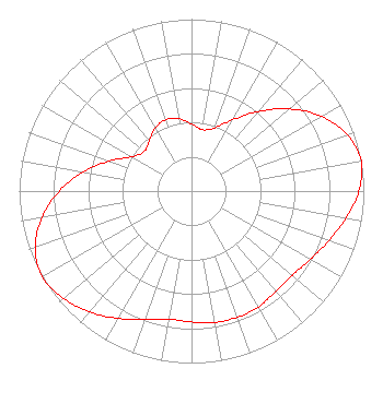
Structure Type: TOWER
Registered To:
Gray Media Group, Inc.
Structure Address:
1500ft Se Of Intersection Us Rt.87 And Leatherwood Rd.
Big Spring, TX
County Name: Howard County
ASR Issued: 02/11/2019
Date Built: 01/25/2005
Site Elevation: 779.1 m (2556 ft.)
Structure Height: 90.8 m (298 ft.)
Height Overall: 90.8 m (298 ft.)
Overall Height AMSL: 869.9 m (2854 ft.)
FAA Determination: 11/04/2004
FAA Study #: 04-ASW-5362-OE
FAA Circular #: 70/7460-1K
Paint & Light FAA Chapters: 4, 8, 12
PRIOR STUDY 2003-ASW-5581-OE
32-16-55.4 N 101-29-35.5 W (NAD 83)
32-16-55.0 N 101-29-34.0 W
(Converted to NAD 27)
KCWO-TV Licensee Information

GRAY TELEVISION LICENSEE, LLC
4370 Peachtree Road, Ne
Atlanta, GA 30319
Phone: 404-504-9828
Limited Liability Company
20090818AAN Applicant Information

ROBERT H. DREWRY
Date: 08/18/2009
Application Certifier
MIDESSA TELEVISION LP
P.o. Box 60150
Midland, TX 79711
Applicant
ROY P. STYPE, III
P. O. Box 807
2324 North Cleveland-massillon Road
Bath, OH 44210-0807
CONSULTING ENGINEERING
DAVID D. OXENFORD
Davis Wright Tremaine Llp

Associated Land Mobile Licenses


(No Records Found)
Associated Microwave Licenses


 KWT86 7 GHz TV Intercity Relay
 KWT87 7 GHz TV Intercity Relay
 WLE595 7 GHz TV Intercity Relay
 WLE613 7 GHz TV Intercity Relay

Study Date: 4/25/2024; Study Duration: 0.1057 Seconds.
Database Sources:
04/25/2024 FCC LMS,
4/23/2024 FCC ASR,
4/23/2024 FCC ULS Microwave, and
4/23/2024 FCC ULS Broadcast Land Mobile.


© 2024 Cavell Mertz & Associates, Inc.
Manassas, Virginia


If you have questions or concerns about the station above please contact the station Licensee.
Comments and questions about FCCInfo can be emailed to: webmaster@fccinfo.com