
FCCInfo.com
A Service of Cavell, Mertz & Associates, Inc.
(855) FCC-INFO
|
|
K15CU-D from 05/02/2011 K15CU-D from 03/10/2011 K15CU-D from 08/23/1989 |
|
|
||||||||||||||||
|
|
Status: License Application Accepted: 07/30/2014 License Expires: 12/01/2022 File Number: BLDTL-20140730AEK Prefix Type: This is BLDTL FCC Website Links: LMS Facility Details This Application Other K15CU-D Applications Including Superseded Applications Mailing Address Correspondence for K15CU-D Correspondence related to application BLDTL-20140730AEK Service Contour - Open Street Map or USGS Map (51 dBu) Service Contour - KML / Google Earth (51 dBu) Rabbit Ears Info Search for K15CU-D Site Location: 36-45-22.8 N 121-30-08.7 W (NAD 83) Site Location: 36-45-22.9 N 121-30-04.9 W (Converted to NAD 27) ERP: 5.74 kW Electrical Beam Tilt: 3 degrees R/C AGL: 39.6 m (130 ft.) R/C AMSL: 977.4 m (3207 ft.) Emission Mask: Simple Site Elevation: 937.8 m. (3077 ft.) Height Overall*: 122.5 m (402 ft.) (* As Filed In This Application, may differ from ASR Data, Below.) Directional Antenna - Antenna Make/Model: Bogner B8UT Antenna ID: 18190 | ||||||||||||||||||
| Antenna Data for Antenna Id: 18190 K15CU-D LD File: BLDTL-20140730AEK Bogner - B8UT Service: LD Standard Pattern: Y Pattern and Field Values Include a 205° Clockwise Rotation | 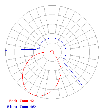 | ||||||||||||||||||
| Azimuth | Ratio | Azimuth | Ratio | Azimuth | Ratio | Azimuth | Ratio | ||||||||||||
| 5 | 0.030 | 15 | 0.030 | 25 | 0.030 | 35 | 0.030 | ||||||||||||
| 45 | 0.030 | 55 | 0.030 | 65 | 0.030 | 75 | 0.030 | ||||||||||||
| 85 | 0.030 | 95 | 0.030 | 105 | 0.030 | 115 | 0.030 | ||||||||||||
| 125 | 0.030 | 135 | 0.060 | 145 | 0.250 | 155 | 0.460 | ||||||||||||
| 165 | 0.600 | 175 | 0.760 | 185 | 0.880 | 195 | 0.970 | ||||||||||||
| 205 | 1.000 | 215 | 0.970 | 225 | 0.880 | 235 | 0.760 | ||||||||||||
| 245 | 0.600 | 255 | 0.460 | 265 | 0.250 | 275 | 0.060 | ||||||||||||
| 285 | 0.030 | 295 | 0.030 | 305 | 0.030 | 315 | 0.030 | ||||||||||||
| 325 | 0.030 | 335 | 0.030 | 345 | 0.030 | 355 | 0.030 | ||||||||||||
Structure Registration Number 1215158 Structure Type: LTOWER Registered To: Hearst Stations Inc. Structure Address: Fremont Peak, Approximatley 16 Km Northeast Of Salinas San Juan Bautis, CA County Name: Monterey County ASR Issued: 11/22/2016 Date Built: 12/05/2002 Site Elevation: 937.8 m (3077 ft.) Structure Height: 121.6 m (399 ft.) Height Overall: 122.5 m (402 ft.) Overall Height AMSL: 1060.3 m (3479 ft.) FAA Determination: 03/19/1999 FAA Study #: 99-AWP-0164-OE FAA Circular #: 70/7460-1J Paint & Light FAA Chapters: 3, 4, 5, 13 36-45-22.8 N 121-30-08.7 W (NAD 83) 36-45-22.9 N 121-30-04.9 W (Converted to NAD 27) |
300 New Jersey Ave, N.w. Suite 700 Washington, DC 20001 Phone: 202-524-6401 Limited Liability Company | Date: 07/30/2014 Application Certifier NBC TELEMUNDO LICENSE LLC 300 New Jersey Avenue, Nw Suite 700 Washington, DC 20001 Applicant H. DOUGLAS LUNG Po Box 98 Honomu, HI 96728-0098 CORPORATE ENGINEERING MANAGER MARGARET L. TOBEY Nbcuniversal. | |||||||||||||||||