|
WAIR Channel: 285A 104.9 MHz
Lake City, Michigan
Service: FM - A full-service FM station or application.
Facility ID: 92345
FRN: 0017040510
Fac. Service: FM
Status: LIC
73.215 Station
Application Accepted: 04/28/2017
Application Granted: 05/18/2017
File Number: BLED-20170428ABF
License Expires: 10/01/2028
Prefix Type: This is a license for a noncommercial educational FM station
Application Type: Amendment
FCC Website Links:
LMS Facility Details
This Application
Other WAIR Applications
Including Superseded Applications
Service Contour - Open Street Map or USGS Map (60 dBu)
Service Contour - KML / Google Earth (60 dBu)
Public Inspection Files
Facility Type: NON-COMMERCIAL EDUC. FM
Class: A, A Zone I; I-A; or II station; with 0.1kW-6kW ERP and a class contour distance <=28km
Site Location: 44-14-56.0 N 85-18-48.2 W (NAD 83)
Site Location: 44-14-56.0 N 85-18-48.0 W (Converted to NAD 27)
Effective Radiated Power: 2.8 kW
Transmitter Output Power: 2 kW
Antenna Center HAAT: 149 m (489 ft.)
Antenna Center AMSL: 554.1 m (1818 ft.)
Antenna Center HAG: 110 m (361 ft.)
Calculated Site Elevation: 444.1 m. (1457 ft.)
Height Overall*: 152.1 m (499 ft.)
(* As Filed In This Application, may differ from ASR Data, Below.)
Directional Antenna
Antenna Make/Model: ETC FM2-CP-DA, TWO SECTIONS
Antenna ID: 118128
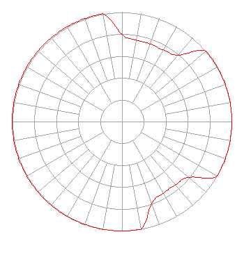
Polarization:
| Associated Translators |
| W273CR(FX) |
Ch. 273 | East Bay Township, Michigan |
|
Structure Information
Structure Registration Number 1000811
Structure Type: GTOWER
Registered To:
WALKER TOWERS L.L.C.
Structure Address:
10861 W Cadillac Rd
Cadillac, MI
County Name: Missaukee County
ASR Issued: 01/12/2018
Date Built: 01/01/1994
Site Elevation: 444.1 m (1457 ft.)
Structure Height: 146.3 m (480 ft.)
Height Overall: 152.1 m (499 ft.)
Overall Height AMSL: 596.2 m (1956 ft.)
FAA Determination: 08/27/1993
FAA Study #: 93-AGL-2148-OE
FAA Circular #: 70/7460-1H
Paint & Light FAA Chapters: 3, 4, 5, 13
44-14-56.0 N 85-18-48.0 W (NAD 83)
44-14-56.0 N 85-18-47.8 W
(Converted to NAD 27)
|
WAIR(FM) Licensee Information
Smile FM
3302 N. Van Dyke
Imlay City, MI 48444
| 20170428ABF Applicant Information
Edward Czelada
Date: 04/28/2017
Application Certifier
Smile FM
3302 N. Van Dyke
Imlay City, MI 48444
Applicant
Edward Czelada
3302 N Van Dyke Rd
Imlay City, MI 48444
President
Edward Czelada
Smile FM
|