|
WMJC Channel: 220A 91.9 MHz
Richland, Michigan
Service: FM - A full-service FM station or application.
Facility ID: 121857
FRN: 0017040197
Fac. Service: FM
Status: LIC
Application Accepted: 08/15/2008
Application Granted: 09/05/2008
File Number: BLED-20080815AAC
License Expires: 10/01/2028
Prefix Type: This is a license for a noncommercial educational FM station
Application Type: Amendment
FCC Website Links:
LMS Facility Details
This Application
Other WMJC Applications
Including Superseded Applications
Service Contour - Open Street Map or USGS Map (60 dBu)
Service Contour - KML / Google Earth (60 dBu)
Public Inspection Files
Facility Type: NON-COMMERCIAL EDUC. FM
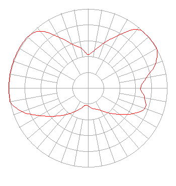
Class: A, A Zone I; I-A; or II station; with 0.1kW-6kW ERP and a class contour distance <=28km
Site Location: 42-27-13.1 N 85-20-39.0 W (NAD 83)
Site Location: 42-27-13.0 N 85-20-39.0 W (Converted to NAD 27)
Effective Radiated Power: 0 kW Horiz. ; 6 kW Vert.
Transmitter Output Power: 1.43 kW
Antenna Center HAAT: 0 m Horiz.; 67.4 m Vert.
Antenna Center AMSL: 0 m Horiz.; 347 m Vert.
Antenna Center HAG: 0 m Horiz.; 55 m Vert.
Calculated Site Elevation: m.
Height Overall*: 79 m (259 ft.)
(* As Filed In This Application, may differ from ASR Data, Below.)
Directional Antenna
Antenna Make/Model: Aldena ALP0802712-DA, 3 section, 1 wavelength spaced
Antenna ID: 88342
Polarization:
| Associated Translators |
| W247AM(FX) |
Ch. 247 | Kalamazoo, Michigan |
|
Structure Information
Structure Registration Number 1060254
[ASR Heights Differ from WMJC Application]
Structure Type: GTOWER
Registered To:
American Towers, LLC
Structure Address:
13740 Trick Road (305734)
Delton, MI
County Name: Barry County
ASR Issued: 02/07/2020
Date Built: 03/31/1998
Site Elevation: 292.3 m (959 ft.)
Structure Height: 79.2 m (260 ft.)
Height Overall: 79.2 m (260 ft.)
Overall Height AMSL: 371.5 m (1219 ft.)
FAA Determination: 11/30/2012
FAA Study #: 2012-AGL-10409-OE
FAA Circular #: 70/7460-1J
Paint & Light FAA Chapters: 4, 8, 13
PRIOR STUDY 2009-AGL-349-OE
42-27-13.0 N 85-20-39.0 W (NAD 83)
42-27-12.9 N 85-20-39.0 W
(Converted to NAD 27)
|
WMJC(FM) Licensee Information
West Central Michigan Media Ministries
Cadillac, MI 49601
Phone: 231-468-2087
Not-for-Profit | 20080815AAC Applicant Information
Mike MacIntosh
Date: 08/15/2008
Application Certifier
Horizon Christian Fellowship
5331 Mount Alifan Drive
San Diego, CA 92111-2622
Applicant
Robert H Branch Jr
212 Honey Tree Lane
Lynchburg, VA 24502
Technical Consultant
Harry C. Martin
Fletcher, Heald & Hildreth, P.L.C.
|