
FCCInfo.com
A Service of Cavell, Mertz & Associates, Inc.
(855) FCC-INFO
|
|
|
|
|
||||||||||||||||
|
|
WAWE-FM4 Channel: 232D 94.3 MHz Glendale Heights, Illinois Service: FB - A booster station or application for a booster. Facility ID: 759359 Fac. Service: FB Programming Delivery Method: Unspecified Status: License Application Accepted: 07/27/2021 Application Granted: 07/30/2021 File Number: -0000154200 License Expires: 12/01/2028 Application Type: License To Cover FCC Website Links: LMS Facility Details This Application Other WAWE-FM4 Applications Other WAWE-FM4 Applications in CDBS Including Superseded Applications Mailing Address Correspondence for WAWE-FM4 Correspondence related to application -0000154200 Service Contour - Open Street Map or USGS Map (60 dBu) Service Contour - KML / Google Earth (60 dBu) Facility Type: NON-COMMERCIAL EDUC. FM Class: D, A Noncommercial educational operating with no more than 10W Site Location: 41-56-18.0 N 87-45-05.0 W (NAD 83) Site Location: 41-56-17.9 N 87-45-04.8 W (Converted to NAD 27) Effective Radiated Power: 0.099 kW Antenna Center HAAT: 0 m Antenna Center AMSL: 299.8 m (984 ft.) Antenna Center HAG: 113 m (371 ft.) Site Elevation: 186.8 m. (613 ft.) Height Overall*: 162.2 m (532 ft.) (* As Filed In This Application, may differ from ASR Data, Below.) Directional Antenna Antenna Make/Model: Shivley 6025 Antenna ID: 1007166 Polarization: H
| ||||||||||||||||||
| Antenna Data for Antenna Id: 1007166 WAWE-FM4 FB File: -0000154200 Shivley - 6025 Service: FB | 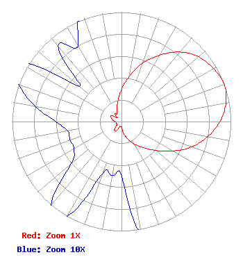 | ||||||||||||||||||
| Azimuth | Ratio | Azimuth | Ratio | Azimuth | Ratio | Azimuth | Ratio | ||||||||||||
| 0 | 0.290 | 10 | 0.420 | 20 | 0.570 | 30 | 0.700 | ||||||||||||
| 40 | 0.830 | 50 | 0.920 | 60 | 0.970 | 70 | 1.000 | ||||||||||||
| 80 | 0.970 | 90 | 0.900 | 100 | 0.800 | 110 | 0.680 | ||||||||||||
| 120 | 0.540 | 130 | 0.410 | 140 | 0.310 | 150 | 0.240 | ||||||||||||
| 160 | 0.170 | 170 | 0.110 | 180 | 0.050 | 190 | 0.050 | ||||||||||||
| 200 | 0.050 | 210 | 0.100 | 220 | 0.100 | 230 | 0.060 | ||||||||||||
| 240 | 0.050 | 250 | 0.050 | 260 | 0.050 | 270 | 0.060 | ||||||||||||
| 280 | 0.080 | 290 | 0.100 | 300 | 0.110 | 310 | 0.050 | ||||||||||||
| 320 | 0.090 | 330 | 0.080 | 340 | 0.120 | 350 | 0.190 | ||||||||||||
Structure Registration Number 1010769 Structure Type: LTOWER Registered To: Vertical Bridge Towers III, LLC Structure Address: 4949 W Belmont Ave / Us-il-1220 Chicago, IL County Name: Cook County ASR Issued: 04/09/2019 Date Built: 07/01/1971 Site Elevation: 186.8 m (613 ft.) Structure Height: 161.1 m (529 ft.) Height Overall: 162.2 m (532 ft.) Overall Height AMSL: 349 m (1145 ft.) FAA Determination: 03/27/2019 FAA Study #: 2019-AGL-2281-OE FAA Circular #: 70/7460-1L Paint & Light FAA Chapters: 4, 8, 12 41-56-18.0 N 87-45-05.0 W (NAD 83) 41-56-17.9 N 87-45-04.8 W (Converted to NAD 27) |
5700 West Oaks Boulevard Rocklin, CA 95765 Phone: 916-251-1600 Not-for-Profit | Title: Ceo Date: 07/27/2021 Application Certifier EDUCATIONAL MEDIA FOUNDATION Educational Media Foundation 5700 West Oaks Boulevard Rocklin, CA 95765 Applicant Bert Goldman Goldman Engineering Management 560 Perkins Way Auburn, CA 95603 Technical Consultant MARY O'CONNOR Wilkinson Barker Knauer, Llp 1800 M. Street, N.w., Suite 800n Washington, DC 20036 JAMES TRAVIS Educational Media Foundation 5700 West Oaks Blvd Rocklin, CA 95765 FCC COMPLIANCE ENGINEER | |||||||||||||||||