
FCCInfo.com
A Service of Cavell, Mertz & Associates, Inc.
(855) FCC-INFO
|
|
|
|
|
||||||||||||||||
|
|
W247DL Channel: 247D 97.3 MHz Westfield, Massachusetts Service: FX - A translator or application for a translator. Facility ID: 144790 Fac. Service: FX Programming Delivery Method: Unspecified Status: License Application Accepted: 11/30/2020 Application Granted: 09/08/2021 File Number: -0000128157 License Expires: 04/01/2022 Application Type: License To Cover FCC Website Links: LMS Facility Details This Application Other W247DL Applications Other W247DL Applications in CDBS Including Superseded Applications Mailing Address Correspondence for W247DL Correspondence related to application -0000128157 Service Contour - Open Street Map or USGS Map (60 dBu) Service Contour - KML / Google Earth (60 dBu) Facility Type: FM STATION Class: D, A Noncommercial educational operating with no more than 10W Site Location: 42-05-05.0 N 72-42-12.0 W (NAD 83) Site Location: 42-05-04.7 N 72-42-13.7 W (Converted to NAD 27) Effective Radiated Power: 0 kW Horiz. ; 0.25 kW Vert. Antenna Center HAAT: 0 m Antenna Center AMSL: 0 m Horiz.; 252 m Vert. Antenna Center HAG: 0 m Horiz.; 57 m Vert. Site Elevation: 195 m. (640 ft.) Height Overall*: 160 m (525 ft.) (* As Filed In This Application, may differ from ASR Data, Below.) Directional Antenna Antenna Make/Model: Scala CL-FMV/RM Antenna ID: 133495 Polarization: H
| ||||||||||||||||||
| Antenna Data for Antenna Id: 133495 W247DL FX File: -0000128157 Scala - CL-FMV/RM Service: FX | 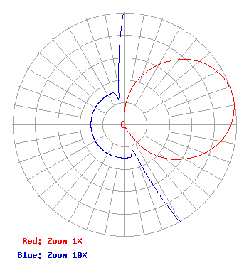 | ||||||||||||||||||
| Azimuth | Ratio | Azimuth | Ratio | Azimuth | Ratio | Azimuth | Ratio | ||||||||||||
| 0 | 0.110 | 10 | 0.300 | 20 | 0.468 | 30 | 0.618 | ||||||||||||
| 40 | 0.756 | 50 | 0.873 | 60 | 0.952 | 70 | 0.993 | ||||||||||||
| 75 | 1.000 | 80 | 0.993 | 90 | 0.952 | 100 | 0.873 | ||||||||||||
| 110 | 0.756 | 120 | 0.618 | 130 | 0.468 | 140 | 0.300 | ||||||||||||
| 150 | 0.110 | 160 | 0.030 | 170 | 0.030 | 180 | 0.030 | ||||||||||||
| 190 | 0.030 | 200 | 0.030 | 210 | 0.030 | 220 | 0.030 | ||||||||||||
| 230 | 0.030 | 240 | 0.030 | 250 | 0.030 | 260 | 0.030 | ||||||||||||
| 270 | 0.030 | 280 | 0.030 | 290 | 0.030 | 300 | 0.030 | ||||||||||||
| 310 | 0.030 | 320 | 0.030 | 330 | 0.030 | 340 | 0.030 | ||||||||||||
| 350 | 0.030 | ||||||||||||||||||
Structure Registration Number 1004484 Structure Type: TOWER Registered To: Nexstar Media Inc. Structure Address: 591 N West St Feeding Hills, MA County Name: Hampden County ASR Issued: 05/28/2021 Date Built: 01/01/1974 Site Elevation: 195 m (640 ft.) Structure Height: 139 m (456 ft.) Height Overall: 160 m (525 ft.) Overall Height AMSL: 355 m (1165 ft.) Paint & Light FAA Chapters: 1, 3, 4, 13, 21 42-05-05.0 N 72-42-12.0 W (NAD 83) 42-05-04.7 N 72-42-13.7 W (Converted to NAD 27) |
7136 S. Yale Avenue Suite 501 Tulsa, OK 74136 Phone: 918-664-4581 Corporation | Title: Svp, Re, Facilities And Corp Development Date: 11/30/2020 Application Certifier CLEAR CHANNEL BROADCASTING LICENSES, INC. Clear Channel Broadcasting Licenses, Inc. 7136 S. Yale Avenue Suite 501 Tulsa, OK 74136 Applicant FCC Contact Clear Channel Broadcasting Licenses, Inc. 7136 S. Yale Avenue Suite 501 Tulsa, OK 74136 | |||||||||||||||||