|
KBLV Channel: 204B 88.7 MHz
Tehachapi, California
Service: FM - A full-service FM station or application.
Facility ID: 122216
FRN: 0004121000
Fac. Service: FM
Status: LIC
Application Accepted: 10/09/2009
Application Granted: 10/27/2009
File Number: BLED-20091009AEF
License Expires: 12/01/2029
Prefix Type: This is a license for a noncommercial educational FM station
Application Type: License To Cover
FCC Website Links:
LMS Facility Details
This Application
Other KBLV Applications
Including Superseded Applications
Service Contour - Open Street Map or USGS Map (60 dBu)
Service Contour - KML / Google Earth (60 dBu)
Public Inspection Files
Facility Type: NON-COMMERCIAL EDUC. FM
Class: B, A Zone I or I-A station; with 25kW-50kW ERP and a class contour distance 39km-52km
Site Location: 35-27-10.8 N 118-35-28.3 W (NAD 83)
Site Location: 35-27-11.0 N 118-35-25.0 W (Converted to NAD 27)
Effective Radiated Power: 0.39 kW
Transmitter Output Power: 0.31 kW
Antenna Center HAAT: 1126 m (3694 ft.)
Antenna Center AMSL: 2348 m (7703 ft.)
Antenna Center HAG: 48 m (157 ft.)
Calculated Site Elevation: 2300 m. (7546 ft.)
Height Overall*: 70 m (230 ft.)
(* As Filed In This Application, may differ from ASR Data, Below.)
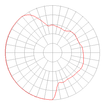
Directional Antenna
Antenna Make/Model: Electronics Research Inc. LP-2E-DA-HW
Antenna ID: 79924
Polarization:
| Associated Translators |
| K296GG(FX) |
Ch. 296 | Tehachapi, California |
|
Structure Information
Structure Registration Number 1015228
Structure Type: TOWER
Registered To:
Sinclair Bakersfield Licensee, LLC
Structure Address:
Atop Breckenridge Mountain
Bakersfield, CA
County Name: Kern County
ASR Issued: 01/10/2017
Date Built: 04/23/2007
Site Elevation: 2299.7 m (7545 ft.)
Structure Height: 50.3 m (165 ft.)
Height Overall: 70.1 m (230 ft.)
Overall Height AMSL: 2369.8 m (7775 ft.)
FAA Determination: 04/23/1969
FAA Study #: 69-LAX-211-OE
Paint & Light FAA Chapters: 1, 3, 11, 21
RED LIGHTS/PAINT
35-27-10.8 N 118-35-28.3 W (NAD 83)
35-27-11.0 N 118-35-25.0 W
(Converted to NAD 27)
|
KBLV(FM) Licensee Information
Educational Media Foundation
5700 West Oaks Blvd.
Rocklin, CA 95765
Phone: 916-251-1600
Not-for-Profit | 20091009AEF Applicant Information
Mike Novak
Date: 10/09/2009
Application Certifier
Educational Media Foundation
5700 West Oaks Blvd
Rocklin, CA 95765
Applicant
Sam Wallington
5700 West Oaks Blvd
Rocklin, CA 95765
VP of Engineering
Karen A. Ross, Esq
Davis Wright Tremaine LLP
|