
FCCInfo.com
A Service of Cavell, Mertz & Associates, Inc.
(855) FCC-INFO
|
|
K220JK from 02/28/2006 K220JK from 04/23/1998 |
|
|
||||||||||||||||
|
|
K220JK Channel: 220D 91.9 MHz Gardendale, Texas Service: FX - A translator or application for a translator. Facility ID: 88872 Fac. Service: FX Programming Delivery Method: Unspecified Status: License Application Accepted: 07/16/2019 Application Granted: 07/19/2019 File Number: BMLFT-20190716AAU License Expires: 00/00/0000 Prefix Type: This is a modification of license for a translator Application Type: Minor Modification FCC Website Links: LMS Facility Details This Application CDBS Application Other K220JK Applications Other K220JK Applications in CDBS Including Superseded Applications Mailing Address Correspondence for K220JK Correspondence related to application BMLFT-20190716AAU Service Contour - Open Street Map or USGS Map (60 dBu) Service Contour - KML / Google Earth (60 dBu) Class: D, A Noncommercial educational operating with no more than 10W Site Location: 32-02-54.4 N 102-18-05.5 W (NAD 83) Site Location: 32-02-54.0 N 102-18-04.0 W (Converted to NAD 27) Effective Radiated Power: 0 kW Horiz. ; 0.092 kW Vert. Transmitter Output Power: 0.085 kW Antenna Center HAAT: 147.6 m Horiz.; 0 m Vert. Antenna Center AMSL: 0 m Horiz.; 1036 m Vert. Antenna Center HAG: 0 m Horiz.; 144 m Vert. Site Elevation: 892 m. (2927 ft.) Height Overall*: 146 m (479 ft.) (* As Filed In This Application, may differ from ASR Data, Below.) Directional Antenna Antenna Make/Model: None Antenna ID: 16130 Polarization:
| ||||||||||||||||||
| Antenna Data for Antenna Id: 16130 K220JK FX File: BMLFT-20190716AAU None - Service: FX Pattern and Field Values Include a 115° Clockwise Rotation | 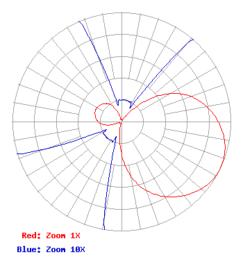 | ||||||||||||||||||
| Azimuth | Ratio | Azimuth | Ratio | Azimuth | Ratio | Azimuth | Ratio | ||||||||||||
| 5 | 0.020 | 15 | 0.020 | 25 | 0.020 | 35 | 0.030 | ||||||||||||
| 45 | 0.185 | 55 | 0.410 | 65 | 0.600 | 75 | 0.735 | ||||||||||||
| 85 | 0.840 | 95 | 0.923 | 105 | 0.980 | 115 | 1.000 | ||||||||||||
| 125 | 0.980 | 135 | 0.923 | 145 | 0.840 | 155 | 0.735 | ||||||||||||
| 165 | 0.600 | 175 | 0.410 | 185 | 0.185 | 195 | 0.030 | ||||||||||||
| 205 | 0.020 | 215 | 0.020 | 225 | 0.020 | 235 | 0.020 | ||||||||||||
| 245 | 0.025 | 255 | 0.125 | 265 | 0.195 | 275 | 0.230 | ||||||||||||
| 285 | 0.250 | 295 | 0.260 | 305 | 0.250 | 315 | 0.230 | ||||||||||||
| 325 | 0.195 | 335 | 0.125 | 345 | 0.025 | 355 | 0.020 | ||||||||||||
Structure Registration Number 1053974 [ASR Heights Differ from K220JK Application] Structure Type: GTOWER Registered To: American Towers LLC Structure Address: 16841 Derby Ave Gardendale, TX County Name: Ector County ASR Issued: 01/05/2021 Date Built: 01/01/1981 Site Elevation: 891.5 m (2925 ft.) Structure Height: 143.9 m (472 ft.) Height Overall: 146.3 m (480 ft.) Overall Height AMSL: 1037.8 m (3405 ft.) FAA Determination: 08/16/2018 FAA Study #: 2018-ASW-12027-OE FAA Circular #: 70/7460-1L Paint & Light FAA Chapters: 4, 8, 12 OM&L to remain the same as original issue date 08/16/2018 = A MED-DUAL SYSTEM 32-02-54.6 N 102-18-05.6 W (NAD 83) 32-02-54.2 N 102-18-04.1 W (Converted to NAD 27) |
P.o. Box 391 4002 N. 3300 E. Twin Falls, ID 83303 Phone: 208-733-3133 | Date: 07/16/2019 Application Certifier CALVARY CHAPEL OF TWIN FALLS, INC. P.o. Box 291 Twin Falls, ID 83303 Applicant LOIS MILLS Po Box 391 Twin Falls, ID 83303 APPLICATION TECHNICIAN CARY TEPPER Tepper Law Firm, Llc 4900 Auburn Ave., Suite 100 Bethesda, MD 20814-2632 | |||||||||||||||||