
FCCInfo.com
A Service of Cavell, Mertz & Associates, Inc.
(855) FCC-INFO
|
|
W207CG from 01/17/2007 W207CG from 07/07/2006 W207CG from 04/14/2004 |
|
|
||||||||||||||||
|
|
W207CG Channel: 207D 89.3 MHz Bowling Green, Kentucky Service: FX - A translator or application for a translator. Facility ID: 140701 Fac. Service: FX Programming Delivery Method: Unspecified Status: License Application Accepted: 09/20/2012 Application Granted: 10/11/2012 File Number: BLFT-20120920ABL License Expires: 00/00/0000 Prefix Type: This is a license for a translator Application Type: License To Cover FCC Website Links: LMS Facility Details This Application CDBS Application Other W207CG Applications Other W207CG Applications in CDBS Including Superseded Applications Mailing Address Correspondence for W207CG Correspondence related to application BLFT-20120920ABL Service Contour - Open Street Map or USGS Map (60 dBu) Service Contour - KML / Google Earth (60 dBu) Class: D, A Noncommercial educational operating with no more than 10W Site Location: 37-02-45.2 N 86-21-53.0 W (NAD 83) Site Location: 37-02-45.0 N 86-21-53.0 W (Converted to NAD 27) Effective Radiated Power: 0 kW Horiz. ; 0.027 kW Vert. Transmitter Output Power: 0.018 kW Antenna Center HAAT: 0 m Horiz.; 65.4 m Vert. Antenna Center AMSL: 0 m Horiz.; 238 m Vert. Antenna Center HAG: 0 m Horiz.; 70 m Vert. Site Elevation: 168 m. (551 ft.) Height Overall*: 103 m (338 ft.) (* As Filed In This Application, may differ from ASR Data, Below.) Directional Antenna Antenna Make/Model: None Antenna ID: 103957 Polarization:
| ||||||||||||||||||
| Antenna Data for Antenna Id: 103957 W207CG FX File: BLFT-20120920ABL None - Service: FX Pattern and Field Values Include a 225° Clockwise Rotation | 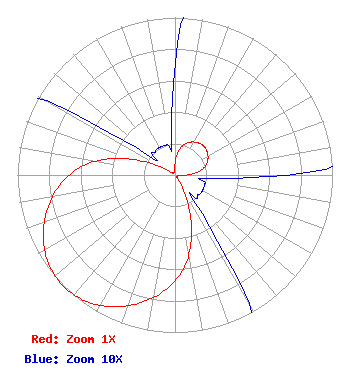 | ||||||||||||||||||
| Azimuth | Ratio | Azimuth | Ratio | Azimuth | Ratio | Azimuth | Ratio | ||||||||||||
| 5 | 0.125 | 15 | 0.195 | 25 | 0.230 | 35 | 0.250 | ||||||||||||
| 45 | 0.260 | 55 | 0.250 | 65 | 0.230 | 75 | 0.195 | ||||||||||||
| 85 | 0.125 | 95 | 0.025 | 105 | 0.020 | 115 | 0.020 | ||||||||||||
| 125 | 0.020 | 135 | 0.020 | 145 | 0.030 | 155 | 0.185 | ||||||||||||
| 165 | 0.410 | 175 | 0.600 | 185 | 0.735 | 195 | 0.840 | ||||||||||||
| 205 | 0.923 | 215 | 0.980 | 225 | 1.000 | 235 | 0.980 | ||||||||||||
| 245 | 0.923 | 255 | 0.840 | 265 | 0.735 | 275 | 0.600 | ||||||||||||
| 285 | 0.410 | 295 | 0.185 | 305 | 0.030 | 315 | 0.020 | ||||||||||||
| 325 | 0.020 | 335 | 0.020 | 345 | 0.020 | 355 | 0.025 | ||||||||||||
Structure Registration Number 1046177 Structure Type: TOWER Registered To: ALLEN, KENNETH J Structure Address: Ky Hwy 526 5.9 Mi Ne Bowling Green, KY County Name: Warren County ASR Issued: 05/04/1998 Date Built: 09/01/1972 Site Elevation: 167.6 m (550 ft.) Structure Height: 101.8 m (334 ft.) Height Overall: 102.7 m (337 ft.) Overall Height AMSL: 270.3 m (887 ft.) FAA Determination: 08/29/1968 FAA Study #: CLE-OE-68-32 Paint & Light FAA Chapters: 1, 3, 12, 21 RED LIGHTS/PAINT 37-02-45.0 N 86-21-53.0 W (NAD 83) 37-02-44.8 N 86-21-53.0 W (Converted to NAD 27) |
P.o. Box 391 4002 N. 3300 E. Twin Falls, ID 83303 Phone: 208-733-3133 | Date: 09/20/2012 Application Certifier CALVARY CHAPEL OF TWIN FALLS, INC. Po Box 391 Twin Falls, ID 83303 Applicant LOIS MILLS Po Box 391 Twin Falls, ID 83303 APPLICATION TECHNICIAN CARY TEPPER Booth, Freret, Imlay And Tepper, Pc 7900 Wisconsin Ave, Suite 304 Bethesda, MD 20814-3628 | |||||||||||||||||