
FCCInfo.com
A Service of Cavell, Mertz & Associates, Inc.
(855) FCC-INFO
|
|
W26EY-D from 07/24/2012 W26EY-D from 05/04/2004 |
|
|
||||||||||||||||
|
|
Status: License Application Accepted: 05/03/2021 License Expires: 12/01/2020 File Number: -0000144443 FCC Website Links: LMS Facility Details This Application Other W26EY-D Applications Including Superseded Applications Mailing Address Correspondence for W26EY-D Correspondence related to application -0000144443 Service Contour - Open Street Map or USGS Map (51 dBu) Service Contour - KML / Google Earth (51 dBu) Rabbit Ears Info Search for W26EY-D Site Location: 35-51-54.2 N 75-38-58.4 W (NAD 83) Site Location: 35-51-53.6 N 75-38-59.8 W (Converted to NAD 27) ERP: 15 kW Polarization: Horizontally polarized R/C AGL: 154 m (505 ft.) R/C AMSL: 155.2 m (509 ft.) Emission Mask: Stringent Site Elevation: 1.2 m. (4 ft.) Height Overall*: 166.1 m (545 ft.) (* As Filed In This Application, may differ from ASR Data, Below.) Directional Antenna - Antenna Make/Model: DIELECTRIC TUM-LP-C1-9/9M-1-K Antenna ID: 118181 Polarization: Horizontally polarized | ||||||||||||||||||
| Antenna Data for Antenna Id: 118181 W26EY-D LD File: -0000144443 DIELECTRIC - TUM-LP-C1-9/9M-1-K Service: LD Standard Pattern: Y Pattern and Field Values Include a 330° Clockwise Rotation | 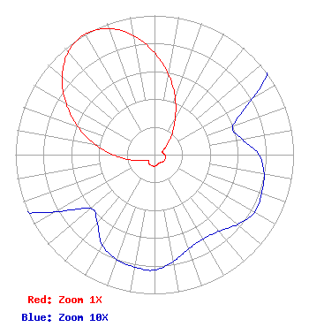 | ||||||||||||||||||
| Azimuth | Ratio | Azimuth | Ratio | Azimuth | Ratio | Azimuth | Ratio | ||||||||||||
| 0 | 0.733 | 10 | 0.584 | 20 | 0.435 | 30 | 0.296 | ||||||||||||
| 40 | 0.198 | 50 | 0.123 | 60 | 0.082 | 70 | 0.060 | ||||||||||||
| 80 | 0.064 | 90 | 0.075 | 100 | 0.080 | 110 | 0.082 | ||||||||||||
| 120 | 0.083 | 130 | 0.078 | 140 | 0.072 | 150 | 0.070 | ||||||||||||
| 160 | 0.072 | 170 | 0.078 | 180 | 0.083 | 190 | 0.082 | ||||||||||||
| 200 | 0.080 | 210 | 0.075 | 220 | 0.064 | 230 | 0.060 | ||||||||||||
| 240 | 0.082 | 250 | 0.123 | 260 | 0.198 | 270 | 0.296 | ||||||||||||
| 280 | 0.435 | 290 | 0.584 | 300 | 0.733 | 310 | 0.868 | ||||||||||||
| 320 | 0.964 | 330 | 1.000 | 340 | 0.964 | 350 | 0.868 | ||||||||||||
Structure Registration Number 1290758 Structure Type: GTOWER Registered To: East Carolina Radio, Inc. Structure Address: West Of Sr 345 Wanchese, NC County Name: Dare County ASR Issued: 03/04/2014 Date Built: 12/12/2014 Site Elevation: 1.2 m (4 ft.) Structure Height: 165.2 m (542 ft.) Height Overall: 166.1 m (545 ft.) Overall Height AMSL: 167.3 m (549 ft.) FAA Determination: 02/22/2013 FAA Study #: 2013-ASO-1326-OE FAA Circular #: 70/7460-1K Paint & Light FAA Chapters: 3, 4, 5, 12 PRIOR STUDY 2012-ASO-4581-OE CHAPTERS 3,4,5,12 (1K) ADD SPECIAL CONDITION FOR LIGHTING DEVIATION. 35-51-54.2 N 75-38-58.4 W (NAD 83) 35-51-53.6 N 75-38-59.8 W (Converted to NAD 27) |
P.o. Box 1418 Nags Head, NC 27959 Phone: 252-449-8331 Sole Proprietorship | Title: Individual Date: 05/03/2021 Application Certifier LAWRENCE F. LOESCH Lawrence F. Loesch P.o. Box 1418 Nags Head, NC 27959 Applicant J. Benjamin Davis Brooks, Pierce Et Al. 150 Fayetteville Street Suite 1700 Raleigh, NC 27601 LAWRENCE F. LOESCH Lawrence F. Loesch P.o. Box 1418 Nags Head, NC 27959 | |||||||||||||||||