
FCCInfo.com
A Service of Cavell, Mertz & Associates, Inc.
(855) FCC-INFO
|
|
K45KS-D from 11/27/2012 K45KS-D from 07/25/2012 K45KS-D from 08/26/2008 K45KS-D from 09/21/2005 |
|
|
||||||||||||||||
|
|
Status: STA – Special Temporary Authority (Licensed And Silent) Application Accepted: 06/29/2021 STA Expires: 00/00/0000 File Number: -0000149735 FCC Website Links: LMS Facility Details This Application Other K45KS-D Applications Including Superseded Applications Mailing Address Correspondence for K45KS-D Correspondence related to application -0000149735 Service Contour - Open Street Map or USGS Map (51 dBu) Service Contour - KML / Google Earth (51 dBu) Rabbit Ears Info Search for K45KS-D Site Location: 45-45-51.3 N 108-27-21.0 W (NAD 83) Site Location: 45-45-51.5 N 108-27-18.5 W (Converted to NAD 27) ERP: 5 kW R/C AGL: 17 m (56 ft.) R/C AMSL: 1140.8 m (3743 ft.) Emission Mask: Stringent Site Elevation: 1123.8 m. (3687 ft.) Height Overall*: 62.8 m (206 ft.) (* As Filed In This Application, may differ from ASR Data, Below.) Directional Antenna - Antenna Make/Model: Aldena ATU.08.07.420 ARRAY Antenna ID: 106234 | ||||||||||||||||||
| Antenna Data for Antenna Id: 106234 K45KS-D LD File: -0000149735 Aldena - ATU.08.07.420 ARRAY Service: LD Standard Pattern: Y Pattern and Field Values Include a 260° Clockwise Rotation | 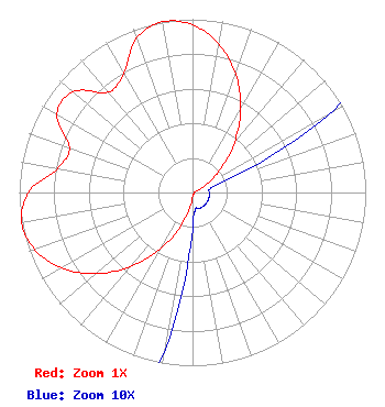 | ||||||||||||||||||
| Azimuth | Ratio | Azimuth | Ratio | Azimuth | Ratio | Azimuth | Ratio | ||||||||||||
| 0 | 0.967 | 10 | 0.872 | 20 | 0.729 | 30 | 0.556 | ||||||||||||
| 40 | 0.378 | 50 | 0.218 | 60 | 0.094 | 70 | 0.021 | ||||||||||||
| 80 | 0.010 | 90 | 0.010 | 100 | 0.010 | 110 | 0.010 | ||||||||||||
| 120 | 0.010 | 130 | 0.010 | 140 | 0.010 | 150 | 0.010 | ||||||||||||
| 160 | 0.010 | 170 | 0.010 | 180 | 0.021 | 190 | 0.094 | ||||||||||||
| 200 | 0.218 | 210 | 0.378 | 220 | 0.556 | 230 | 0.729 | ||||||||||||
| 240 | 0.872 | 250 | 0.967 | 260 | 1.000 | 270 | 0.947 | ||||||||||||
| 280 | 0.793 | 290 | 0.756 | 300 | 0.902 | 310 | 0.902 | ||||||||||||
| 320 | 0.756 | 330 | 0.793 | 340 | 0.947 | 350 | 1.000 | ||||||||||||
Structure Registration Number 1020873 Structure Type: GTOWER Registered To: SBA GC Towers, LLC Structure Address: Colburn Hill 2.6 Mi Ese (mt15943-t) Bilings, MT County Name: Yellowstone County ASR Issued: 05/30/2014 Date Built: 01/01/1977 Site Elevation: 1123.8 m (3687 ft.) Structure Height: 61.3 m (201 ft.) Height Overall: 62.8 m (206 ft.) Overall Height AMSL: 1186.6 m (3893 ft.) FAA Determination: 05/29/2014 FAA Study #: 2014-ANM-1118-OE FAA Circular #: 70/7460-1K Paint & Light FAA Chapters: 3, 4, 5, 12 PRIOR STUDY 1997-ANM-1296-OE 45-45-51.3 N 108-27-21.0 W (NAD 83) 45-45-51.5 N 108-27-18.5 W (Converted to NAD 27) |
Hurst, TX 76054 Phone: 214-770-7770 Corporation | Title: Ceo Date: 06/29/2021 Application Certifier EDGE SPECTRUM, INC. Edge Spectrum, Inc. Hurst, TX 76054 Applicant Caleb Weiss Ark Multicasting, Inc. Cedar Hill, TX 75106 President Randy Weiss Edge Spectrum, Inc. Hurst, TX 76054 CEO Susan Hansen B. W. St. Clair 2305 Vida Shaw Rd. New Iberia, LA 70563 Consultant | |||||||||||||||||