
FCCInfo.com
A Service of Cavell, Mertz & Associates, Inc.
(855) FCC-INFO
|
|
|
|
|
||||||||||||||||
|
|
Status: License Application Accepted: 01/07/2022 License Expires: 02/01/2023 File Number: -0000179173 FCC Website Links: LMS Facility Details This Application Other K06PU-D Applications Including Superseded Applications Mailing Address Correspondence for K06PU-D Correspondence related to application -0000179173 Service Contour - Open Street Map or USGS Map (43 dBu) Service Contour - KML / Google Earth (43 dBu) Rabbit Ears Info Search for K06PU-D Site Location: 46-38-26.0 N 120-23-50.0 W (NAD 83) Site Location: 46-38-26.5 N 120-23-45.8 W (Converted to NAD 27) ERP: 0.3 kW Polarization: Horizontally polarized R/C AGL: 18 m (59 ft.) R/C AMSL: 931 m (3054 ft.) Emission Mask: Stringent Site Elevation: 913 m. (2995 ft.) Height Overall*: 96 m (315 ft.) (* As Filed In This Application, may differ from ASR Data, Below.) Directional Antenna - Antenna Make/Model: Scala CL-46HR Antenna ID: 20784 Polarization: Horizontally polarized | ||||||||||||||||||
| Antenna Data for Antenna Id: 20784 K06PU-D LD File: -0000179173 Scala - CL-46HR Service: LD Standard Pattern: Y Pattern and Field Values Include a 260° Clockwise Rotation | 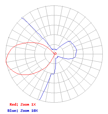 | ||||||||||||||||||
| Azimuth | Ratio | Azimuth | Ratio | Azimuth | Ratio | Azimuth | Ratio | ||||||||||||
| 0 | 0.010 | 10 | 0.010 | 20 | 0.010 | 30 | 0.010 | ||||||||||||
| 40 | 0.020 | 50 | 0.040 | 60 | 0.043 | 70 | 0.045 | ||||||||||||
| 80 | 0.047 | 90 | 0.045 | 100 | 0.043 | 110 | 0.030 | ||||||||||||
| 120 | 0.010 | 130 | 0.010 | 140 | 0.010 | 150 | 0.010 | ||||||||||||
| 160 | 0.010 | 170 | 0.020 | 180 | 0.040 | 190 | 0.050 | ||||||||||||
| 200 | 0.130 | 210 | 0.300 | 220 | 0.460 | 230 | 0.660 | ||||||||||||
| 240 | 0.830 | 250 | 0.940 | 260 | 1.000 | 270 | 0.940 | ||||||||||||
| 280 | 0.840 | 290 | 0.650 | 300 | 0.460 | 310 | 0.290 | ||||||||||||
| 320 | 0.080 | 330 | 0.020 | 340 | 0.010 | 350 | 0.010 | ||||||||||||
Structure Registration Number 1043133 Structure Type: TOWER Registered To: M & G PROPERTY PARTNERS Structure Address: 2950 Eagle Way Yakima Ranches Yakima Ridge Yakima, WA County Name: Yakima County ASR Issued: 04/08/1998 Date Built: 01/01/1985 Site Elevation: 913 m (2995 ft.) Structure Height: 91 m (299 ft.) Height Overall: 96 m (315 ft.) Overall Height AMSL: 1009 m (3310 ft.) FAA Determination: 02/04/1998 FAA Study #: 98-ANM-0065-OE FAA Circular #: 70/7460-1J Paint & Light FAA Chapters: 3, 4, 5, 13 PRIOR FAA 85-ANM-0429-OE 46-38-26.0 N 120-23-50.0 W (NAD 83) 46-38-26.5 N 120-23-45.8 W (Converted to NAD 27) |
868 N. Garfield Ave Montebello, CA 90006 Phone: 213-745-6224 Corporation | Title: President Date: 01/07/2022 Application Certifier LUNA FOODS, INC. Luna Foods, Inc. 1200 W. Venice Blvd. Los Angeles, CA 90006 Applicant Keith Leitch One Ministries. Inc. Santa Rosa, CA 95402 Engineer Aaron P Shainis Shainis & Peltzman, Chartered 1850 M Street Nw Suite 240 Washington, DC 20036 FCC Legal Counsel | |||||||||||||||||