
FCCInfo.com
A Service of Cavell, Mertz & Associates, Inc.
(855) FCC-INFO
|
|
W34FO-D from 12/13/2010 |
|
|
||||||||||||||||
|
|
Status: License Application Accepted: 01/10/2022 License Expires: 04/02/2029 File Number: -0000179561 FCC Website Links: LMS Facility Details This Application Other W34FO-D Applications Including Superseded Applications Mailing Address Correspondence for W34FO-D Correspondence related to application -0000179561 Service Contour - Open Street Map or USGS Map (51 dBu) Service Contour - KML / Google Earth (51 dBu) Rabbit Ears Info Search for W34FO-D Site Location: 33-17-06.2 N 82-35-45.9 W (NAD 83) Site Location: 33-17-05.7 N 82-35-46.4 W (Converted to NAD 27) ERP: 0.2 kW Polarization: Horizontally polarized R/C AGL: 6 m (20 ft.) R/C AMSL: 167.8 m (551 ft.) Emission Mask: Simple Site Elevation: 161.8 m. (531 ft.) Height Overall*: 155.4 m (510 ft.) (* As Filed In This Application, may differ from ASR Data, Below.) Directional Antenna - Antenna Make/Model: Scala CL-1469 Antenna ID: 20778 Polarization: Horizontally polarized | ||||||||||||||||||
| Antenna Data for Antenna Id: 20778 W34FO-D LD File: -0000179561 Scala - CL-1469 Service: LD Standard Pattern: Y Pattern and Field Values Include a 120° Clockwise Rotation | 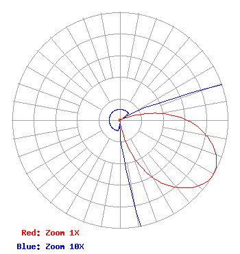 | ||||||||||||||||||
| Azimuth | Ratio | Azimuth | Ratio | Azimuth | Ratio | Azimuth | Ratio | ||||||||||||
| 0 | 0.010 | 10 | 0.010 | 20 | 0.010 | 30 | 0.010 | ||||||||||||
| 40 | 0.010 | 50 | 0.010 | 60 | 0.010 | 70 | 0.086 | ||||||||||||
| 80 | 0.361 | 90 | 0.622 | 100 | 0.812 | 110 | 0.947 | ||||||||||||
| 120 | 1.000 | 130 | 0.947 | 140 | 0.812 | 150 | 0.622 | ||||||||||||
| 160 | 0.361 | 170 | 0.086 | 180 | 0.010 | 190 | 0.010 | ||||||||||||
| 200 | 0.010 | 210 | 0.010 | 220 | 0.010 | 230 | 0.010 | ||||||||||||
| 240 | 0.010 | 250 | 0.010 | 260 | 0.010 | 270 | 0.010 | ||||||||||||
| 280 | 0.010 | 290 | 0.010 | 300 | 0.010 | 310 | 0.010 | ||||||||||||
| 320 | 0.010 | 330 | 0.010 | 340 | 0.010 | 350 | 0.010 | ||||||||||||
Structure Registration Number 1248538 Structure Type: GTOWER Registered To: American Towers LLC Structure Address: Ga Hwy 171 North Of Gibson Gibson, GA County Name: Glascock County ASR Issued: 12/11/2019 Date Built: 03/21/2006 Site Elevation: 161.8 m (531 ft.) Structure Height: 152.4 m (500 ft.) Height Overall: 155.4 m (510 ft.) Overall Height AMSL: 317.2 m (1041 ft.) FAA Determination: 10/15/2019 FAA Study #: 2019-ASO-26830-OE FAA Circular #: 70/7460-1K Paint & Light FAA Chapters: 4, 8, 12 PRIOR STUDY 2011-ASO-7213-OE 33-17-06.2 N 82-35-45.9 W (NAD 83) 33-17-05.7 N 82-35-46.4 W (Converted to NAD 27) |
1498 Buford Hwy Ste C 275 Sugar Hill, GA 30518 Phone: 770-771-1644 Limited Liability Company | Title: President Date: 01/10/2022 Application Certifier DTV INNOVATORS, INC. Dtv Innovators, Inc. 7742 Spalding Dr. Suite 475 Norcross, GA 30092 Applicant Susan Hansen B. W. St. Clair 2305 Vida Shaw Rd New Iberia, LA 70563 CONSULTANT | |||||||||||||||||